


LEE COUNTY, Fla. — During the hours before Lee County leaders made the decision to evacuate, they were evaluating multiple variables in order to make the decision.
According to the County's Incident Action Plan report, which records what discussions were happening inside the Emergency Operations Center, county leaders listed “uncertainty in storm track and lack of storm surge data,” as a reason for not yet making the evacuation call.

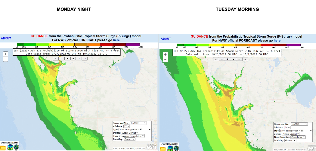
That’s despite consistent communication from the National Hurricane Center during the same time period indicating storm surge would soon impact southwest Florida.
“Decisions were made based on the best available information at the time. As the storm progresses, I can tell you three days out from the storm all of the weather forecasts took the storm into the big bend and slowly began to come south. But even 24 hours in advance, the storm was predicted to go into Tampa,” said County Manager Roger Desjarlais during an Oct. 3, 2022 news conference.
However, documents, obtained by Fox 4 Investigates, show National Weather Service (NWS) leaders consistently outlined Hurricane Ian possibilities as the storm intensified over the Gulf of Mexico.
This included presentations showing worst-case scenarios and multiple storm surge predictions, between Friday, Sept. 23, when Gov. Ron Desantis signed the State of Emergency, and when Ian made landfall on Wednesday, Sept. 28.
“The forecast the National Weather Service released to the public as early as Friday, Sept. 23 was accurate and reasonably probable,” National Hurricane Center Senior Hurricane Specialist Robbie Berg said.
National Hurricane Center tropical advisories show, by Friday, Sept. 23 at 5 a.m. Lee County was in the forecast cone.

By Sept. 24, four days before landfall, NWS-Tampa Warning Coordination Meteorologist Daniel Noah responded to Lee County Public Safety Planning Manager Britton Holdaway’s rainfall forecast request, indicating 3”-5” of rain starting later Tuesday with a total of 6”-10” possible by Wednesday.

Noah ends by forecasting isolated areas could see even higher amounts.
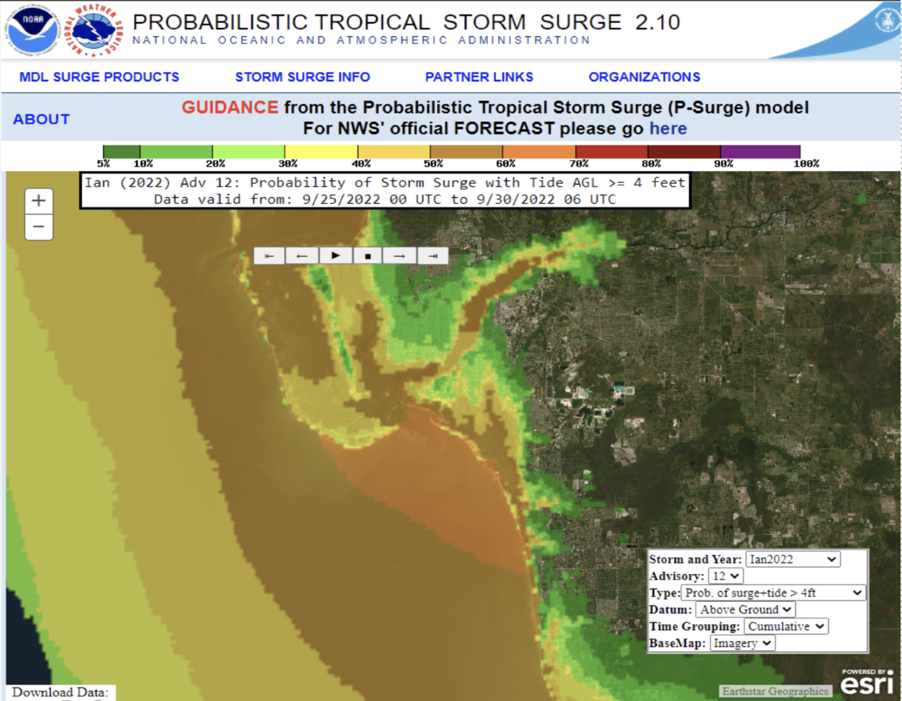
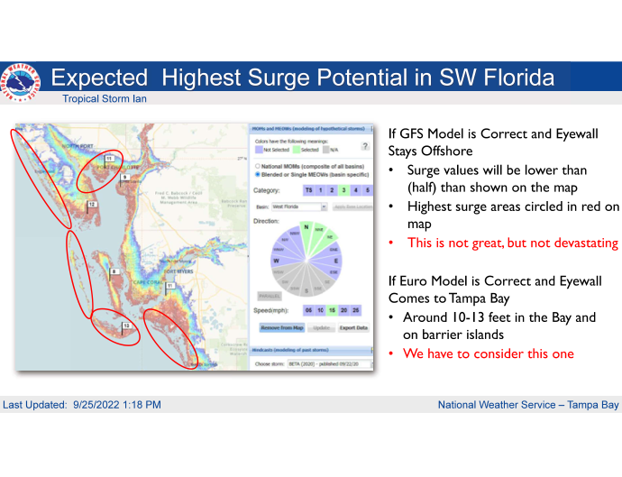
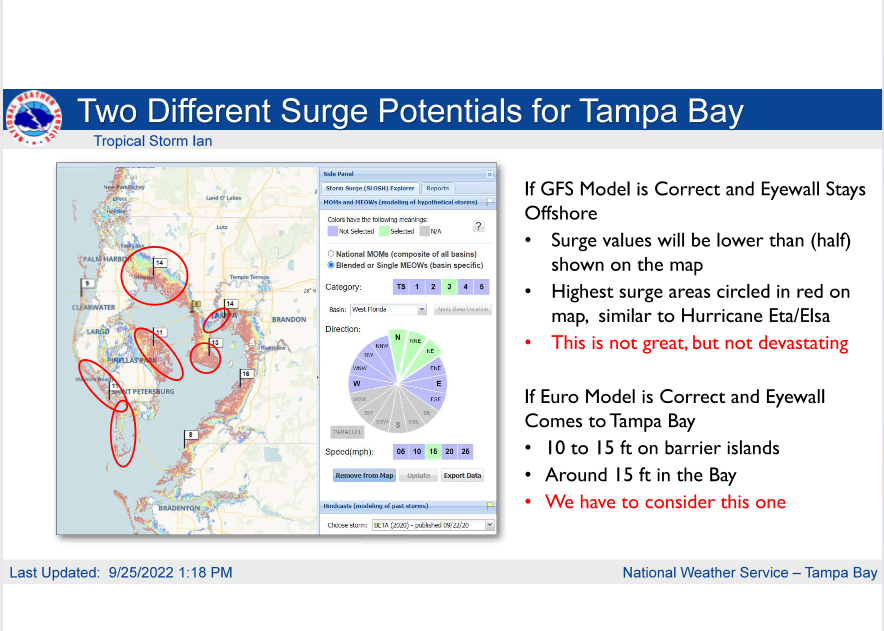
On Sept. 25th, NWS meteorologists tell county leaders about possible worst-case scenarios including 10-15 feet of storm surge from Ft. Myers to Tampa Bay, 111 mile-per-hour winds causing extreme impacts, and said the storm’s overall angle of approach meant Florida’s west coast faced a larger storm surge threat.

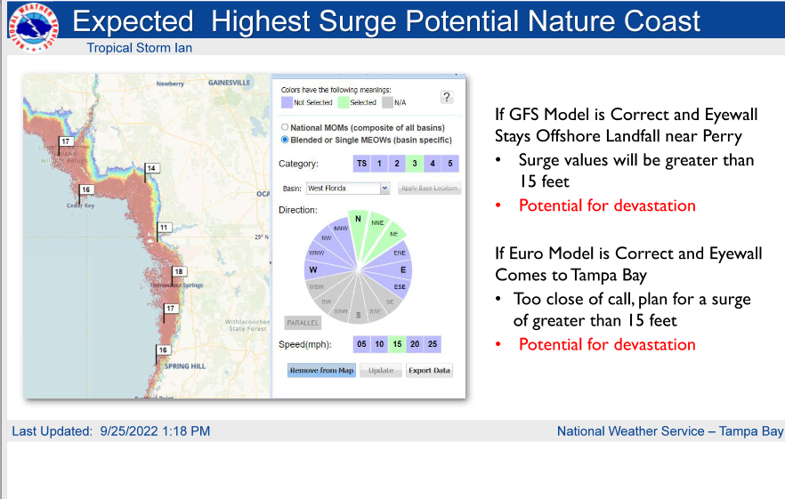
For context, leaders were also told areas to the north along the Nature Coast, Cedar Key, Crystal River, and Hernando Beach, could see 15-20 feet of storm surge.
Next, see Lee County leaders' evacuation decision-making process as Hurricane Ian approached Southwest Florida’s coast.


