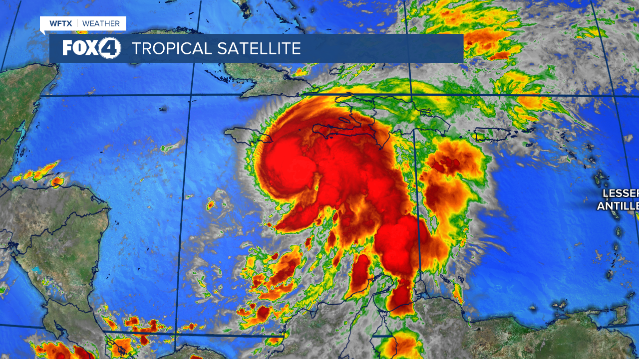


Tropical Storm Melissa is barreling toward Jamaica and could become a major hurricane by Sunday, prompting urgent warnings for residents to complete storm preparations immediately.
As of 8 a.m. EDT Saturday, the storm's center was located about 160 miles southeast of Kingston, Jamaica, according to NOAA and Air Force Reserve Hurricane Hunter aircraft. Melissa is crawling west-northwest at just 1 mph with maximum sustained winds of 70 mph.
The National Hurricane Center forecasts rapid intensification over the next 24 hours, with Melissa expected to reach hurricane status shortly and become a major hurricane by Sunday. Tropical-storm-force winds currently extend up to 115 miles from the storm's center.

Warnings and watches in effect
A Hurricane Warning covers all of Jamaica, meaning hurricane conditions are expected within 36 hours. Officials typically issue these warnings before tropical-storm-force winds arrive, when outdoor preparations become dangerous.
Haiti's southwestern peninsula from the Dominican Republic border to Port-Au-Prince is under both a Hurricane Watch and Tropical Storm Warning. Hurricane conditions are possible in this area, while tropical storm conditions are expected within 36 hours.
Residents in Haiti, the Dominican Republic, eastern Cuba, the Bahamas and the Turks and Caicos Islands should closely monitor Melissa's progress. Additional watches may be issued for portions of eastern Cuba later today.
Devastating rainfall expected
Melissa threatens to dump catastrophic amounts of rain across the region. Southern Hispaniola and Jamaica could see 15 to 25 inches of total rainfall through Tuesday, with local maximums reaching 35 inches across Haiti's Tiburon Peninsula.
Eastern Cuba faces 4 to 8 inches of rainfall, with some areas potentially receiving up to 12 inches by Tuesday. Additional heavy rainfall is likely beyond Tuesday, though exact totals remain uncertain due to the extended timeframe.
The extreme rainfall raises serious concerns about catastrophic flash flooding and landslides across Jamaica and southern Dominican Republic. Southern Haiti faces an anticipated catastrophic flash flooding scenario.

Storm surge and coastal threats
Jamaica's coastline faces increasing danger as Melissa approaches. Minor coastal flooding is likely starting tonight in areas experiencing onshore winds as tropical storm conditions begin.
However, a more life-threatening storm surge threatens Jamaica's south coast later this weekend or early next week. Peak surge heights could reach 5 to 10 feet above ground level near and east of where Melissa's center makes landfall. Large and destructive waves will accompany the surge.
Swells generated by Melissa are expected to affect Hispaniola, Jamaica and eastern Cuba over the next several days.

Timeline and preparations
Tropical storm conditions are expected to begin in Jamaica tonight, with hurricane conditions arriving by Sunday or Monday. Haiti's watch and warning areas should expect tropical storm conditions and possible hurricane conditions later today.
Officials emphasize that all preparations in Jamaica should be completed today due to Melissa's slow movement, which will subject the island to a multi-day period of damaging winds and heavy rainfall.
Haiti faces particular vulnerability, with catastrophic flash flooding and landslides expected across southwestern regions into early next week. This could cause extensive infrastructure damage and potentially isolate communities for prolonged periods.
Residents in eastern Cuba, the Bahamas and Turks and Caicos should monitor Melissa closely as the risk increases for significant storm surge, damaging winds and heavy rainfall by the middle of next week.
