


Here is your forecast for Monday, March 10th, 2025.
Showers and storms are long gone but gusty winds remain. Expect gusts tonight around 30 mph. Those winds drop Tuesday afternoon to 10-15 mph.
It was windy as storms blew through SWFL earlier today. In central FL, a confirmed tornado hit a local TV station. Check out the video here.
Drier air is filtering in on those strong northwesterly winds. This will lead to a clear sky overnight and cooler lows in the 50s.
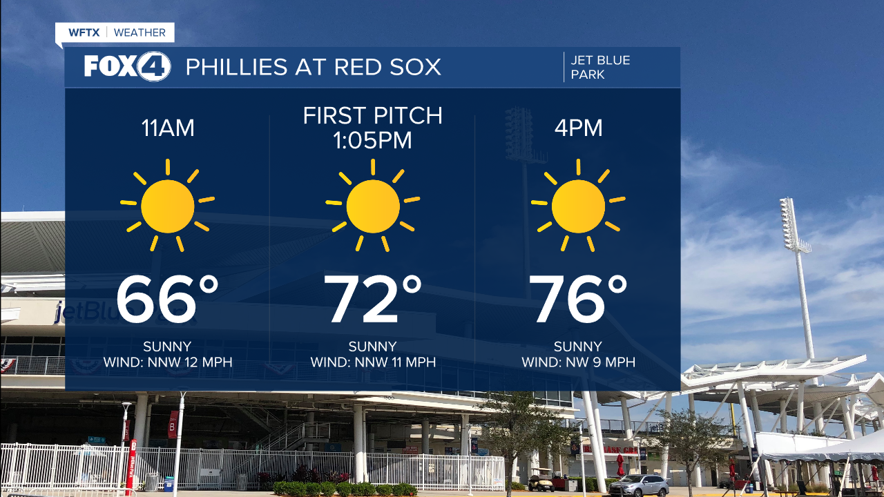
We'll see tons of sun on Tuesday with highs a few degrees cooler than average in the mid to upper 70s. We have two local spring training games tomorrow. Here's what to expect!

The coolest morning behind this front will be Wednesday, when we start in the upper 40s and lower 50s.

A wind shift Wednesday afternoon returns 80° temperatures. Highs late week into the weekend are expected in the mid-80s.
Our next chance for scattered rain is forecast Monday morning with our next cold front.
FOX 4 EVENING METEOROLOGIST KATIE WALLS
If you don't already have our Fox 4 mobile app, you can download it here.
