

Here is your forecast for Thursday, August 7th, 2025.
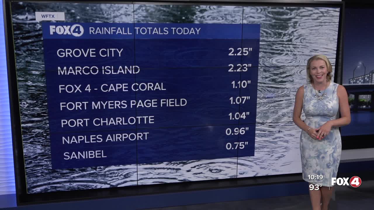
Despite wet and stormy conditions this afternoon, heat index values still reached 105-108° across SWFL. That will be the case again on Friday.
We'll kick off Friday in the mid to upper 70s with mostly sunny skies. High temperatures will climb into the low and mid-90s, feeling more like 100-105° with the humidity. After 2pm, rain chances increase to 70%. Main impacts include heavy rain and lightning.
Over the weekend, elevated tropical moisture will bring us the chance for both morning and afternoon showers and storms. Rain chances will climb to 80%.
With rain earlier in the day, temperatures on Saturday and Sunday will stay in the lower 90s, with feels like temperatures around 100°.
TROPICS:
The National Hurricane Center is no longer issuing advisories for Dexter as it has become post-tropical and continues to move away from the United States. The system will not impact our Southwest Florida community.
Meanwhile, we are keeping an eye on two other areas of interest in the Atlantic Ocean.
A non-tropical area of low pressure is expected to form within the next day or two, several hundred miles offshore of North Carolina. Some tropical or subtropical development is possible this weekend as the system moves northeastward over the warm waters of the Gulf Stream, off the east coast of the United States.
By early next week, the low is expected to reach colder water and more hostile conditions, ending its chance for tropical or subtropical development. The National Hurricane Center gives this system a 10% chance of formation through 48 hours and a 20% chance through 7 days.
Further east in the central tropical Atlantic, a tropical wave is producing disorganized shower activity. Environmental conditions are forecast to become more conducive for gradual development in a few days.
A tropical depression could form late this weekend or early next week while the system moves west-northwestward to northwestward across the central tropical and subtropical Atlantic. This system has a 10% chance of formation through 48 hours and a 60% chance through 7 days.
At this time, neither system looks to be a threat to Southwest Florida, I'll continue to track these systems and provide updates as conditions change.
Speaking of the tropics NOAA updated their hurricane forecast on Thursday. You can read that HERE.
FOX 4 EVENING METEOROLOGIST KATIE WALLS
If you don't already have our Fox 4 mobile app, you can download it here.
