


This is your forecast for Sunday, May 5.
Happy Cinco de Mayo! Showers and storms will be isolated through this evening. Slow-moving downpours may create brief ponding, but otherwise, impact should be limited. Whatever activity we have on radar will wind down by midnight.
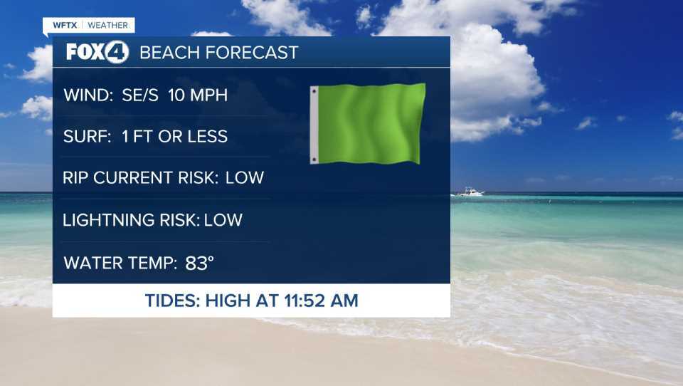
Heading into Monday, we'll start off with sunshine and temperatures around 70°. Easterly winds will become southeasterly around 10 mph. Later in the afternoon, a developing sea breeze with winds out of the southwest along the coastline, will force any thunderstorm activity mainly inland, along and east of I-75. While the coastline stays mainly dry, isolated downpours could impact some afternoon and evening plans. This will also be the case on Tuesday.
With a strengthening ridge, we will trend drier and stay hot as we head into the mid and latter part of the work week. Afternoon temperatures will stay near 90° but feel more like 93° through the work week. (The average high for this time of year is 88°.)
We'll be tracking a cold front next weekend, which will help to return temperatures to average and increase rain chances slightly. We'll continue to fine-tune this potential.
If you don't already have our Fox 4 mobile app, you can download it here.
