


Normally, we don't "deal" with areas of low pressure in the Gulf of Mexico unless they're potential tropical systems between June and November. Not in this case.
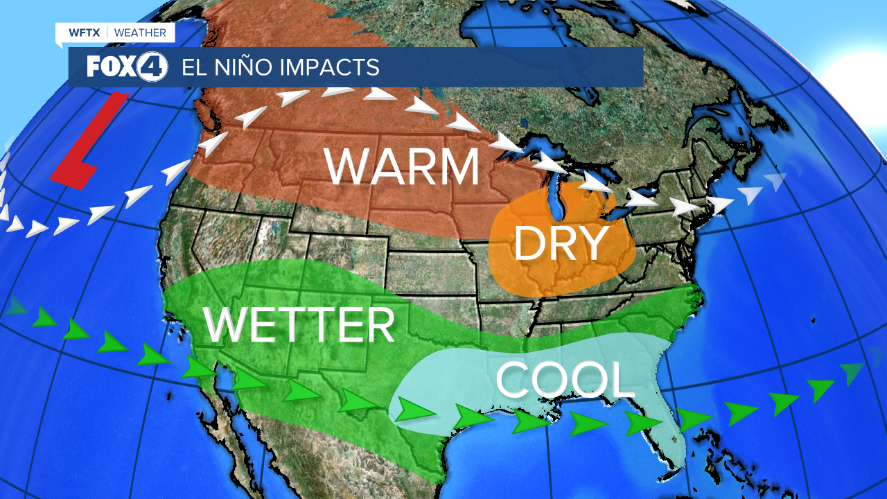
During an El Nino phase, like the one we're in, you can expect to see more of these storm systems impact SWFL.
HERE'S WHY: The subtropical jet stream tends to be stronger and farther south in an El Nino. This shift brings the overall storm track across the southern U.S. and the Gulf of Mexico.
We also tend to see more severe weather events in the winter months during a strong El Nino. This is not the time of year to let your guard down.
The outlook from the Climate Prediction Center for Southwest Florida's 2023-2024 winter season calls for a strengthening El Nino lasting into next spring.
WHAT YOU NEED TO KNOW ABOUT THIS WEEKEND'S STORM SYSTEM (DECEMBER 16-17, 2023)
- 1-4” of rain are possible starting early Saturday morning. Rain will continue through the day and night, ending Sunday morning. Isolated flooding is possible.
- We will see a threat for strong and severe storms, mainly between 6pm Saturday and 6am Sunday.
- The greatest threat for waterspouts and tornadoes will be between 8pm Saturday to 5am Sunday.
- 30-45 mph wind gusts will continue through the weekend, especially Sunday.
- COASTAL FLOODING of 1-2 feet will be possible Sunday as winds shift and become onshore. This will cause some roads along the coast to go under water, especially during high tide.
If you don't already have our Fox 4 mobile app, you can download it here.
