


UPDATE 8/28/21 11 AM:
Julian formed with the 11 AM advisory in the middle of the Atlantic. It poses no threat to land. Also TD 10 continues its slow move northward and also will remain in the open Atlantic away from any land areas.
FOX 4 CHIEF METEOROLOGIST DEREK BEASLEY
UPDATE 8/28/21 8 AM:
We now have two tropical depressions in the Atlantic. TD 10 and TD 11. Neither storm will affect land areas as they track into the northern Atlantic this week.
FOX 4 CHIEF METEOROLOGIST DEREK BEASLEY
UPDATE 8/28/21 8 PM:
Tropical Depression 10 is still looking ragged due to heavy wind shear. Wind speeds are near 30 knots as the system moves through the Atlantic. The system has a chance of becoming a tropical storm by Sunday before weakening again. It will continue to move through the Atlantic and poses no threat to Southwest Florida.
A second area of showers and thunderstorms continues to show signs of organization over the central Atlantic. This system could turn into a tropical depression later tonight or on Sunday. In a couple of days, the system is forecast to be absorbed by a frontal system. Still, the National Hurricane Center is giving this a high chance of development.
FOX 4 FORECASTER LAUREN PETRELLI
UPDATE 8/28/21 8 AM:
NHC is now issuing advisories on Tropical Depression 10 in the Atlantic. This system is located in the middle of the Atlantic between the Lesser Antilles and the Cabo Verde Islands. It is expected to become Tropical Storm Julian soon but will stay in the open Atlantic with no threat to land through its entire forecast track.
Invest 97L remains in the Atlantic east of Bermuda but is struggling due to shear. It will also be no threat to land.
FOX 4 CHIEF METEOROLOGIST DEREK BEASLEY
UPDATE 8/27/21 11 AM:
The National Hurricane Center continues to monitor two areas in addition to Ida in the tropics. First, an elongated area of low pressure located over the central Atlantic about 600 miles east of Bermuda is producing showers and thunderstorms. The system is expected to drift eastward today and Saturday. A tropical depression could still form over the weekend. It has a medium chance of development over the next 48 hours.
The second area is a tropical wave located about midway between the Cabo Verde Islands and the Lesser Antilles. Gradual development of this system is expected, however, it will eventually move into an environment of stronger upper-level winds and slightly cooler waters. This area has a high chance of development over the next 48 hours.
FOX 4 FORECASTER LAUREN PETRELLI
UPDATE 8/26/21 8 PM
Invest 97 and 98 in the Atlantic will be tropical cyclones soon both have HIGH chances for development in 5 days but they will be "fish storms", finding a weakness in the Bermuda-Azores High and heading out to sea.
FOX 4 CHIEF METEOROLOGIST DEREK BEASLEY
UPDATE 8/26/21 8:00 AM
No major changes with the 8AM Tropical Weather Update from the National Hurricance Center this morning.
All eyes remain on the developing low pressure area south of Jamaica.
Environmental conditions remain conducive for additional development, and a tropical depression or tropical storm is expected to form later today or tonight while the system moves northwestward over the northwestern Caribbean. Given the recent developmental trends, Tropical Storm Warnings for the Cayman Islands and western Cuba could be required later this morning, and an Air Force Reserve reconnaissance aircraft is scheduled to investigate the system this afternoon.
The system is expected to enter into the Gulf of Mexico Friday night and continue moving northwestward toward the central or northwestern U.S. Gulf coast, potentially bringing dangerous impacts from storm surge, wind, and heavy rainfall to portions of the coasts of Texas, Louisiana, Mississippi, Alabama, and the Florida Panhandle by Sunday and Monday. However, uncertainty in the system's exact track and intensity remains large since the low is just beginning to form.
Formation chance through 48 hours is high at 90 percent.
Formation chance through 5 days is high at 90 percent.

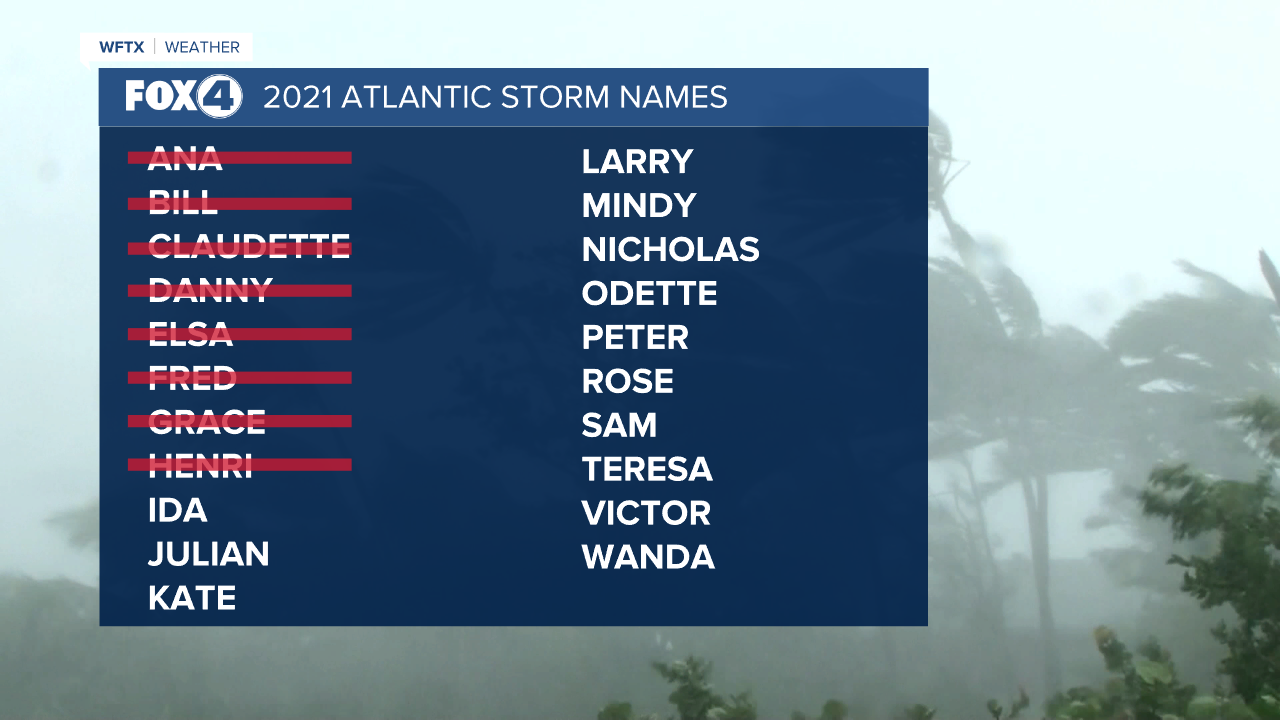
The next name on the list is Ida
FOX 4 MORNING METEOROLOGIST TRENT ARIC
SPECIAL UPDATE 8/26/21 5:05 AM
Shower and thunderstorm activity continues to become better organized in association with a trough of low pressure located less than 200 miles south of Jamaica. Environmental conditions remain conducive for development, and a tropical depression or storm is expected to form later today or tomorrow. This system is forecast to move northwestward over the northwestern Caribbean Sea near the Cayman Islands tonight, near Cuba and the Yucatan Peninsula of Mexico on Friday, and into the Gulf of Mexico this weekend. Given the recent developmental trends, Tropical Storm Warnings for the Cayman Islands and Tropical Storm Watches for western Cuba could be required later today.
FOX 4 MORNING METEOROLOGIST TRENT ARIC
UPDATE 8/24/21 8 PM
Invest 99L and Invest 97L both have a HIGH chance for development in 5 days. 99L is the system we are watching that appears to be organizing in the Caribbean. There is an upper level low pressure near it that is creating a little westerly shear, but sea surface temperatures are very warm and it is in an overall favorable environment for strengthening. As of now it is just a trough of low pressure. It is expected to develop a low level circulation near the Yucatan Peninsula by this weekend then track across the Gulf. Environmental conditions will be very favorable for strengthening and several forecast models are bullish on developing a significant hurricane in the Gulf headed toward the northern Gulf coast early next week.
There are still no indications that this will be an eventual problem for South Florida despite the eastward trend in the forecast models.
97L and 98L will stay harmlessly out in the Atlantic as they both will find a weakness in the Bermuda High and stay away from land, with the exception being the Azores next week.
FOX 4 CHIEF METEOROLOGIST DEREK BEASLEY
UPDATE 8/25/21 8AM
The National Hurricane Center is monitoring three areas this morning and one of which could possibly impact the U.S. coastline early next week.
Let's start with that one in this update. Currently that system is a tropical wave currently located over northwestern Colombia and the south-central Caribbean Sea. The environmental conditions are forecast to be favorable for development, and a tropical depression is likely to form late this week or over the weekend while the system moves west-northwestward to northwestward over the northwestern Caribbean. Once this system moves into the western Gulf of Mexico by Sunday conditions are likely to be favorable for additional development to occur.
A few of the more reliable computer models are indicating that a hurricane could possibly be approaching the Texas or Louisiana coastline early next week. At the moment there is still a lot of uncertainty to this system as there is yet to be a trackable center.

As it currently stands:
Formation chance through 48 hours is medium at 40 percent.
Formation chance through 5 days is high at 80 percent.

The next name on the list is Ida followed by Julian then Kate.
The second area, regardless of development will stay safely out in the middle of the Atlantic. Currently this broad trough of low pressure is producing disorganized showers and thunderstorms over the central tropical Atlantic about 800 miles southeast of Bermuda. Only slow development of this system is expected during the next day or so due to unfavorable upper-level winds. Afterwards, environmental conditions are forecast to become more conducive for development, and a tropical depression is likely to form late this week or this weekend while the system turns eastward over the central Atlantic.
Formation chance through 48 hours is low at 30 percent.
Formation chance through 5 days is high at 80 percent.

The third and final area is a tropical wave over the far eastern tropical Atlantic located several hundred miles southwest of the Cabo Verde Islands that is producing a disorganized area of showers and thunderstorms. Some development of this system is possible over the next several days while it moves west-northwestward at 10 to 15 mph over the eastern tropical Atlantic. Upper-level winds are forecast to become less conducive for development by this weekend.
Formation chance through 5 days is low at 30 percent
Formation chance through 48 hours is low at 20 percent.

FOX 4 MORNING METEOROLOGIST TRENT ARIC
UPDATE 8/24/21 8PM
We now have Invest 99L in the Caribbean, joining Invests 97L and 98L. 99L is the only one that could become a U.S. hurricane threat down the road (next week). The greatest potential for organization will come once it gets away from the Yucatan Peninsula and it looks like the Texas coast will have a fair shot at seeing a storm next week. The latest forecast models are converging on this area, although Louisiana could come into play if the upper level high pressure ridge weakens earlier than forecast. Conditions are nearly ideal with low wind shear, very warm water temperatures over 30° C and a moist atmospheric profile from the ground up. 99L will be one to watch in the coming days.
97L has a HIGH chance for development in 5 days and will likely be the next named storm (Ida). Julian will follow. Stay tuned as things start t get interesting in the tropics leading up to the peak of the season.
FOX 4 CHIEF METEOROLOGIST DEREK BEASLEY
FIRST UPDATE 8/24/21 8 AM
NHC is monitoring 3 areas of possible tropical development this week.
The first area is Invest 97L located west of the Cabo Verde Islands. This disturbance will move northwest and remain in the Atlantic. It has a HIGH chance for development in 5 days. Besides Bermuda, it poses no threat to land.
The second is Invest 98L which is located just east of 97L near the Cabo Verde Islands. This disturbance will track northwest toward the middle of the Atlantic with a LOW chance for development in 5 days. It also poses no threat to land.
The last wave is moving through the Caribbean and will approach Central America late this week. This system also has MEDIUM (soon HIGH) chance for development in 5 days as it tracks west. Long-range forecast models, particularly the American GFS model are bullish on developing this system into a hurricane and tracking it toward South Texas or northern Mexico by late this weekend or early next week. It will be a race between this disturbance and 97L as to which one will be come Ida, the next named storm, first.
None of these look to be a threat to South Florida eventually, so no worries. We will continue to monitor them and give you the latest as they develop.
FOX 4 CHIEF METEOROLOGIST DEREK BEASLEY
