

Here is your forecast for Thursday, October 2nd, 2025.
We'll wrap up your work week windy with a better chance for scattered showers and storms, especially each afternoon.
Friday will start off partly cloudy with temperatures in the low to mid-70s. High temperatures are expected in the upper 80s.
Winds in the morning are expected out of the northeast between 15-20 mph.
Wind gusts will increase more-so in the afternoon, up to 30 mph.

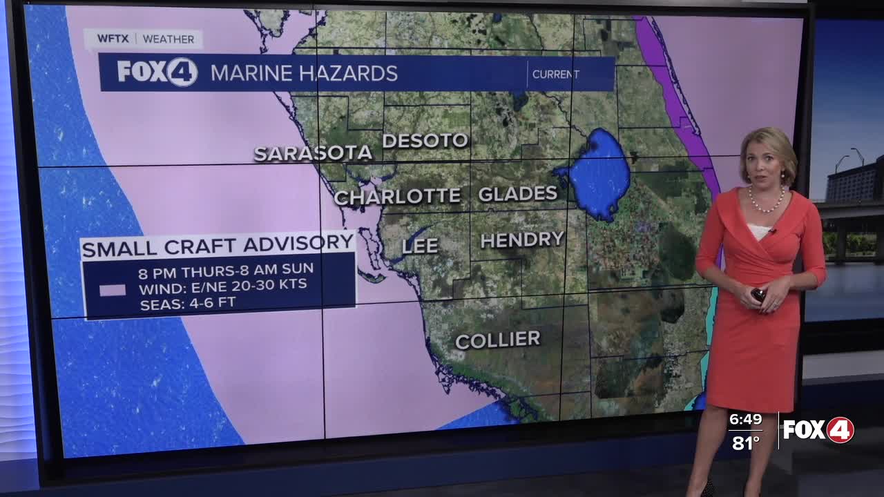
Because of these windy conditions, a Small Craft Advisory is in effect through Sunday morning. For Collier county, this will expire early on Saturday morning.

While an isolated shower can't be ruled out in the morning, we'll see a better chance for showers after 2pm. A few embedded storms will be possible. Those scattered showers are expected to clear out by 8pm.
Over the weekend, scattered showers and storms are expected each afternoon.
As for the tropical disturbance over the Bahamas, the risk of development is low. Regardless of formation this weekend, it will bring the threat for isolated flooding to Florida's east coast but have little impact on our weather in SWFL, aside from a wind shift. CLICK HERE FOR THE LATEST
FOX 4 EVENING METEOROLOGIST KATIE WALLS
If you don't already have our Fox 4 mobile app, you can download it here.
