

Here is your forecast for Tuesday, September 23rd, 2025.
This evening we are tracking shower and thunderstorms, focused more inland. Radar should be drying out by 10pm.
The rest of the night will see partly cloudy skies as temperatures drop into the mid 70s.
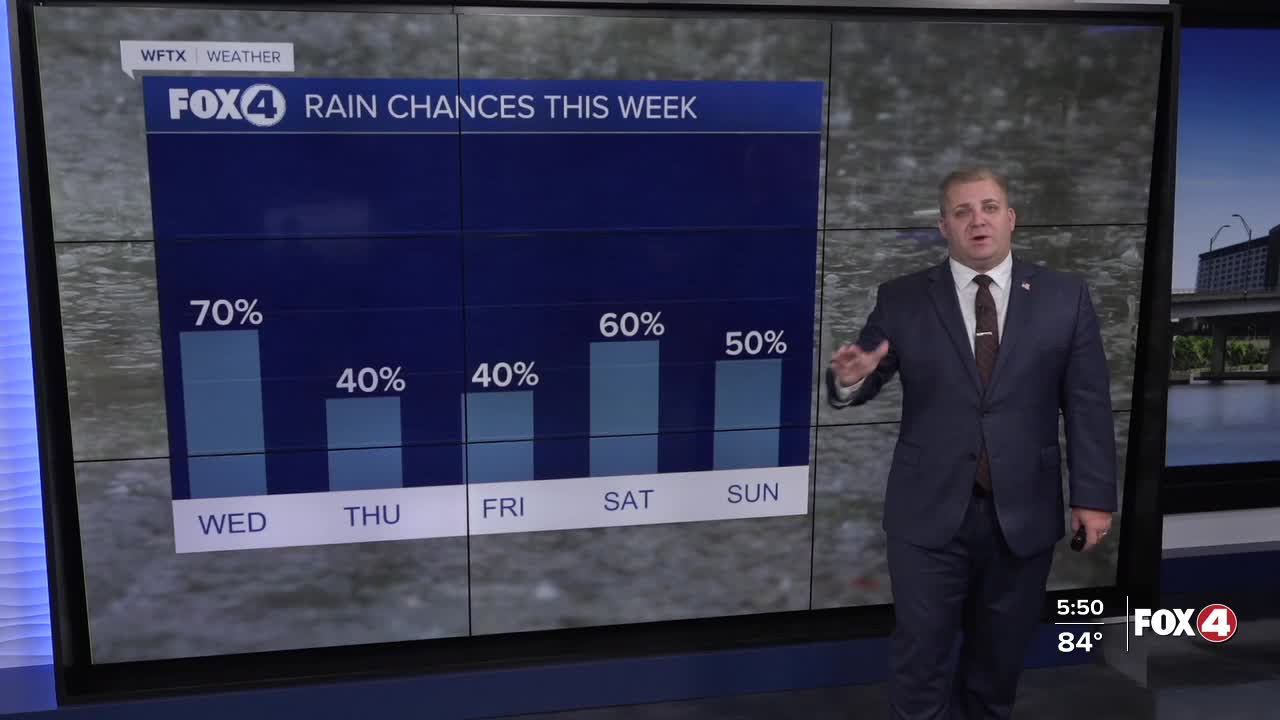
For your Wednesday, we should see a bit more sunshine with afternoon storms developing after 2pm.
Looking ahead, slightly drier air will arrive on Thursday and Friday. This will drop rain chances to around 40%.
This coming weekend our weather pattern will get a bit more interesting. We will be tracking a frontal boundary arriving and likely stalling over the state. Meanwhile, Invest 94L will likely be east of state, in the Atlantic. This could bring a bit more unsettled weather.
Overall much drier air, will return early next week in the wake of the front. Unfortunately, this 'cold' front will be bringing much in term of fall temperatures to Southwest Florida.
FOX 4 METEOROLOGIST ANDREW SHIPLEY
If you don't already have our Fox 4 mobile app, you can download it here.
