

Here is your forecast for Thursday, December 18th, 2025.
Temperatures have been exceptionally warm today, despite extra clouds, all ahead of our next cold front.
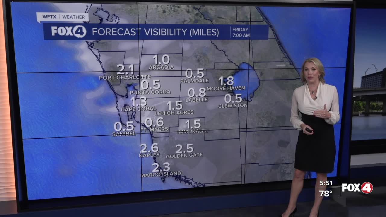
Warm southerly winds will keep our dew points elevated overnight. These muggier dew points around 70° will also set us up for developing fog between 4-8am.
A few showers are possible tonight through the morning ahead of our next cold front. That front will clear SWFL by lunch time.
In its wake, drier air will filter in and clouds will gradually clear late in the day. Temperatures will still hit the lower 80s in the afternoon. Overnight into Saturday morning will be a little cooler in the 50s, but in terms of impacts of that front? That's about it.
Temperatures Saturday afternoon rebound into the lower 80s. Sunday, the start of winter, is forecast to hit 84°!
Looking ahead to the week of Christmas, it will be feeling more like April as a large upper level ridge builds across most of the country, including right here in SWFL.
Dreaming of a "white Christmas"? You'll have to head to the beach and make sand angels. Our Christmas in SWFL will be feeling more like April! pic.twitter.com/tWn4uc7EmS
— Katie Walls, CCM, CBM (@KatieWallsTV) December 18, 2025
FOX 4 EVENING METEOROLOGIST KATIE WALLS
If you don't already have our Fox 4 mobile app, you can download it here.
