

Here is the forecast for Thursday, February 26th, 2026.
Good morning, Southwest Florida! We are waking up much warmer this morning with temperatures in the upper 40s to mid 50s. This is a 10-15° increase from yesterday morning. Today we will see our winds start east, turn south and end up out of the southwest gusting in the mid to upper teens. This will help drive our highs into the low 80s today as the warmup continues.
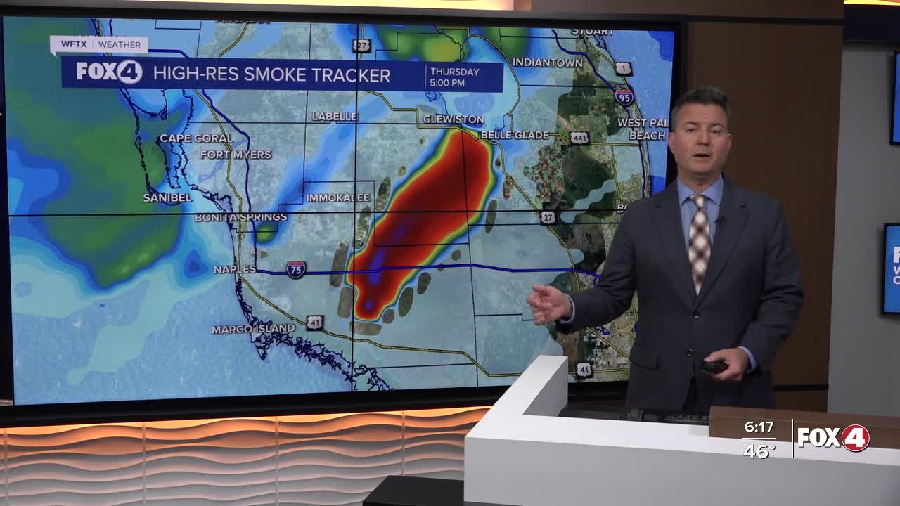
This turn in the wind will push some smoke towards Marco Island and Naples early, then push it north along SR 29 towards Ave Maria and Immokalee and eventually move it northeast towards Lake Okeechobee. The "National Fire" is something we will continue to monitor along with the smoke and any further possible closures of I-75,
As we wrap up the workweek we get even warmer with highs in the mid 80s tomorrow.
Some much needed rain arrives on Saturday with our next front. Scattered rain is expected in the morning and afternoon Saturday with highs in the low 80s.
Sunday will be the drier of the two days over the weekend with partly cloudy skies and a high in the low 80s. Looking ahead to early next week, we stay warm and sunny with highs in the mid 80s.
FOX 4 MORNING METEOROLOGIST TRENT ARIC
If you don't already have our Fox 4 mobile app, you can download it here.
