

Here is your forecast for Wednesday, September 17th, 2025.
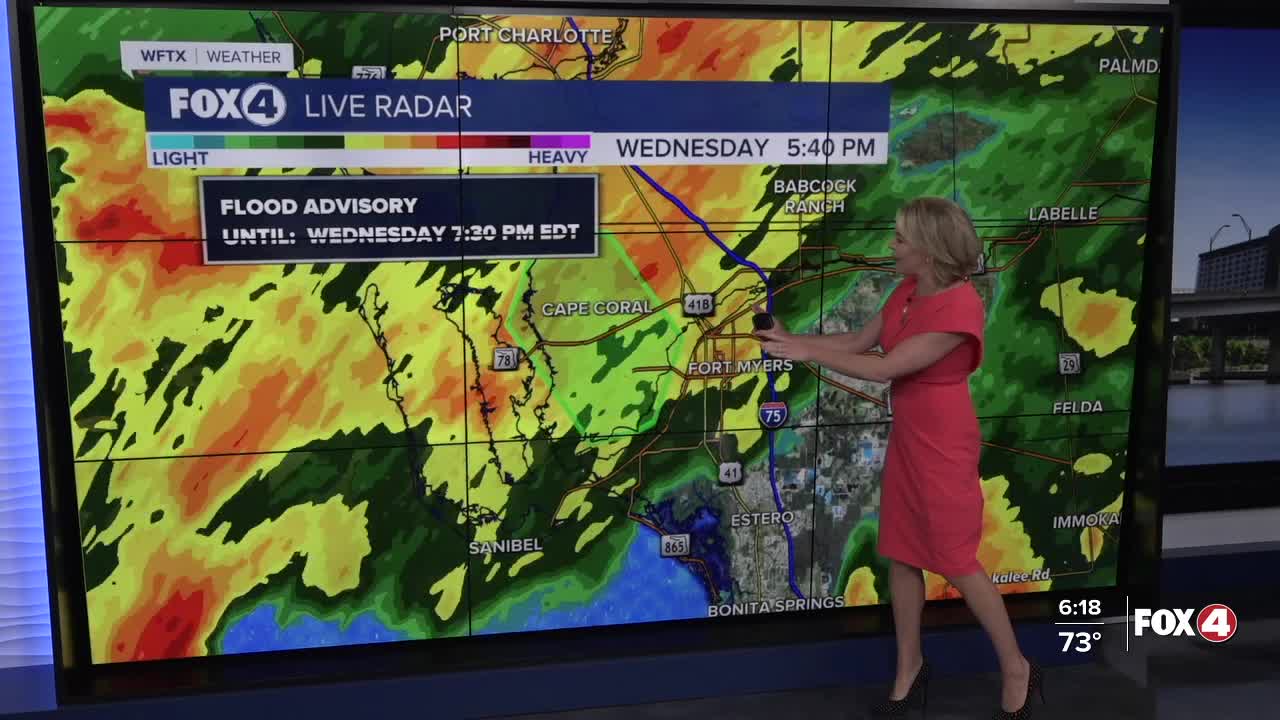
2-4" of rainfall have fallen across SWFL this afternoon, leading to localized flooding.
2-4" of rain have fallen across much of SWFL this afternoon, leading to localized flooding, especially in downtown Fort Myers. This round of wet weather is starting to wind down. The lightning threat for the rest of this evening is "low". pic.twitter.com/LdtaKhVWUG
— Katie Walls, CCM, CBM (@KatieWallsTV) September 17, 2025
This round of rain will wind down by 10pm. The lightning threat for the rest of this evening will stay "low".
Overnight will be mostly cloudy with lows in the low to mid-70s. A shower or two isn't out of the question Thursday morning. The best chance for scattered showers and storms will be developing after 2pm. Rain chances will increase to 60%.
Easterly winds will gust up to 15 mph. High temperatures are expected around 90°.
Drier air is expected to return on Friday, lowering our rain chances to 30% in the afternoon. This will also lead to hotter temperatures in the lower 90s.
Afternoon scattered showers and storms are expected over the weekend with probability around 40%, typical of rainy season. Highs over the weekend will run in the lower 90s.
CLICK HERE FOR THE LATEST ON TROPICAL STORM GABRIELLE
FOX 4 EVENING METEOROLOGIST KATIE WALLS
If you don't already have our Fox 4 mobile app, you can download it here.
