

Here is your forecast for Sunday, August 3rd, 2025.
We are starting today in the upper 70s and lower 80s with a few showers and storms along the coast.
Once southwesterly winds kick up, the best chance for scattered rain will shift inland, along and east of I-75, especially after Noon.
Highs on Sunday will be in the low to mid 90s once again with feels like temperatures in the triple digits. A heat advisory will be in effect starting at 11am until 7pm for Glades, Hendry, and Collier Counties as feels like temperatures warm as high as 109°.
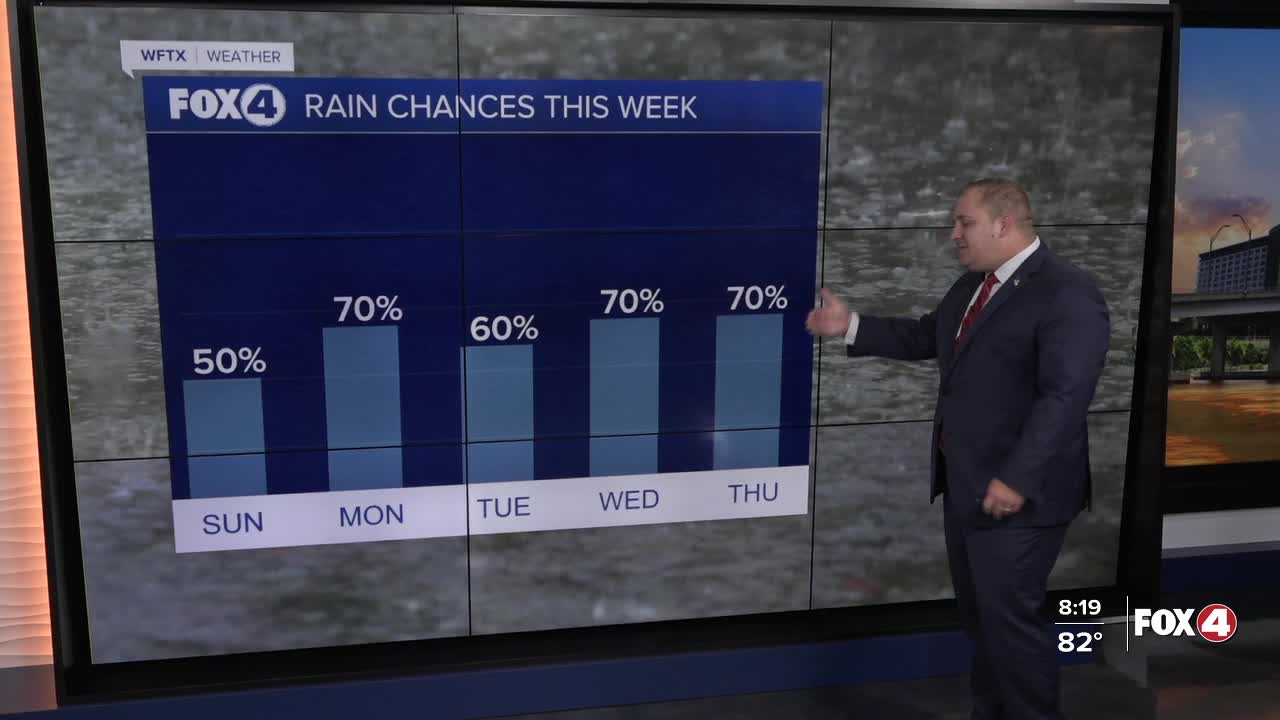
A little higher rain chances will return by midweek as Southeasterly flow returns to the state.
TROPICS:

A non-tropical area of low pressure (Invest 95L) located about 180 miles off the coast of North Carolina has a 50% chance of developing into a tropical or subtropical depression or storm today or Monday, according to the National Hurricane Center.
The system is currently producing disorganized showers and thunderstorms along a frontal boundary. Environmental conditions are marginally conducive for development as it moves east-northeastward at about 10 mph, away from the North Carolina coast.
After Monday, environmental conditions become less conducive for development.

Meanwhile, the National Hurricane Center is also monitoring a tropical wave that is expected to move off the west coast of Africa in the next day or two. Some gradual development of this system is possible during the middle to latter part of next week as it moves generally west-northwestward across the central tropical Atlantic.
The National Hurricane Center gives this second system a 0% chance of formation in the next 48 hours and a 30% chance through the next 7 days.
FOX 4 METEOROLOGIST ANDREW SHIPLEY
If you don't already have our Fox 4 mobile app, you can download it here.
