

Here is your forecast for Friday, July 18th, 2025.
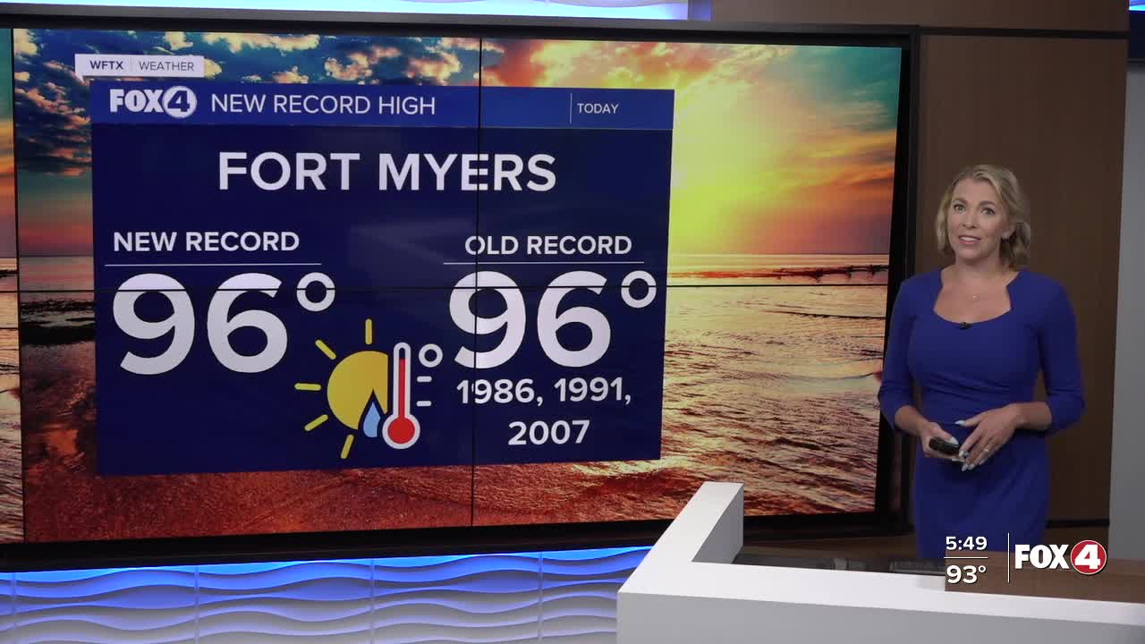
96° tied the record in Fort Myers, last reached in 2007. With the humidity, it felt more like 106°. Tomorrow will be similar.
NEW RECORD SET IN FORT MYERS: 96° tied the former record set in 1986, 1991, and 2007. For Naples, 96° was 1° shy of the record but marked the hottest day since August 2, 2024. #flwx pic.twitter.com/0fYMRfrU3Z
— Katie Walls, CCM, CBM (@KatieWallsTV) July 18, 2025
Heat will remain the primary concern this weekend. Heat index values will feel more like 100°+ from 11am onward and ultimately feel more like 105-110° in the afternoon.
Take frequent breaks in the shade and drink plenty of water.
Heat advisories are issued if those values hit 108°. The National Weather Service will decide that later tonight, but none are currently in effect.
As drier air moves into Southwest Florida our rain chances will only be around 20% on Saturday afternoon and 30% Sunday afternoon. The majority of us won't be cooler down by rain to help cool us off.
Looking ahead to next week, our chance of rain climbs back up on Monday with a 60% chance of afternoon showers and storms. That rain chance increase up to 80% by Wednesday as we return to our wet weather pattern with highs in the upper 80s to near 90°.
TROPICS UPDATE
TROPICS UPDATE: A tropical wave is producing disorganized showers and thunderstorms. It could develop early next week as it moves west. By the midweek, conditions are forecast to become unfavorable for development. Bottom line, it is not forecast to be a concern to SWFL. #flwx pic.twitter.com/PJLtyF8dub
— Katie Walls, CCM, CBM (@KatieWallsTV) July 19, 2025
FOX 4 EVENING METEOROLOGIST KATIE WALLS
If you don't already have our Fox 4 mobile app, you can download it here.
