

Here is your forecast for Wednesday, August 13th, 2025.
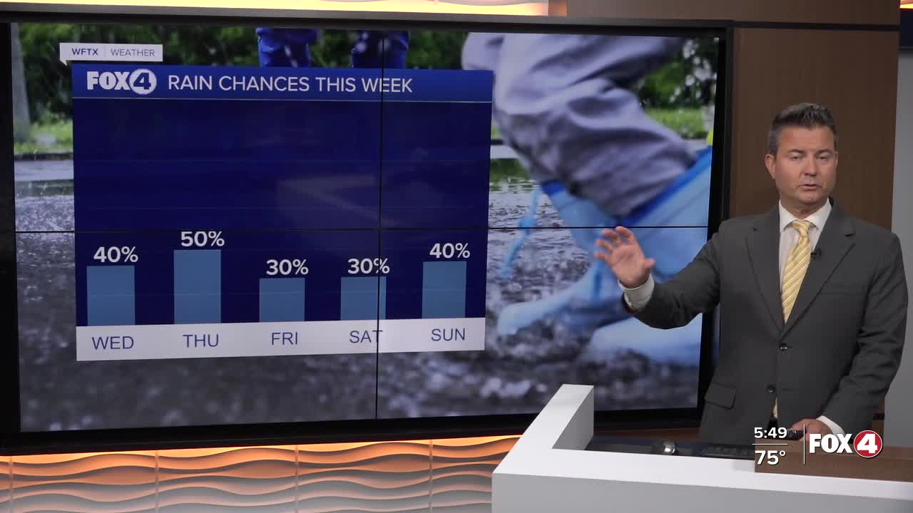
We are waking up dry with temperatures in the mid to upper 70s so the commute to work and school should be pretty smooth weather wise this morning. This afternoon with plenty of sunshine our highs will reach 94° before the wet weather arrives across the area. The first showers could pop up around 2-3PM with the strongest storms arriving between 5PM-7PM. The rain should taper off and be done around 9PM. Our rain chance is between 40-50% as we won't see as many storms this afternoon.
Tomorrow our highs will be back in the low to mid 90s and the rain chance will be around 50%. There will be showers and storms, but they will be more scattered in the afternoon when compared to earlier in the week.
The rain chances will continue to drop over the weekend and could be as low as 20-30% with highs in the mid 90s.
In the tropics, we are still monitoring Erin out in the Atlantic, roughly 1500 miles east of the northern Leeward Islands. This storm will likely be the first hurricane of the season later this week Thursday night into Friday morning and will continue to strengthen into a major hurricane, a category 3 or higher, on Sunday as it moves north of the the Lesser Antilles. At the moment, it is simply to far our to know if Erin could have any impacts of the U.S. Currently, the long range computer models are hinting at a turn to the north early next week if indeed a weakness develops in the Bermuda High. We will have to stay tuned in the week ahead.
FOX 4 MORNING METEOROLOGIST TRENT ARIC
If you don't already have our Fox 4 mobile app, you can download it here.
