

Here is your forecast for Wednesday, August 13th, 2025.
This evening we are tracking a few scattered t-storms, but most of that activity should be done by 8pm. The rest of the night we will see partly cloudy skies with temperatures cooling into the upper 70s.
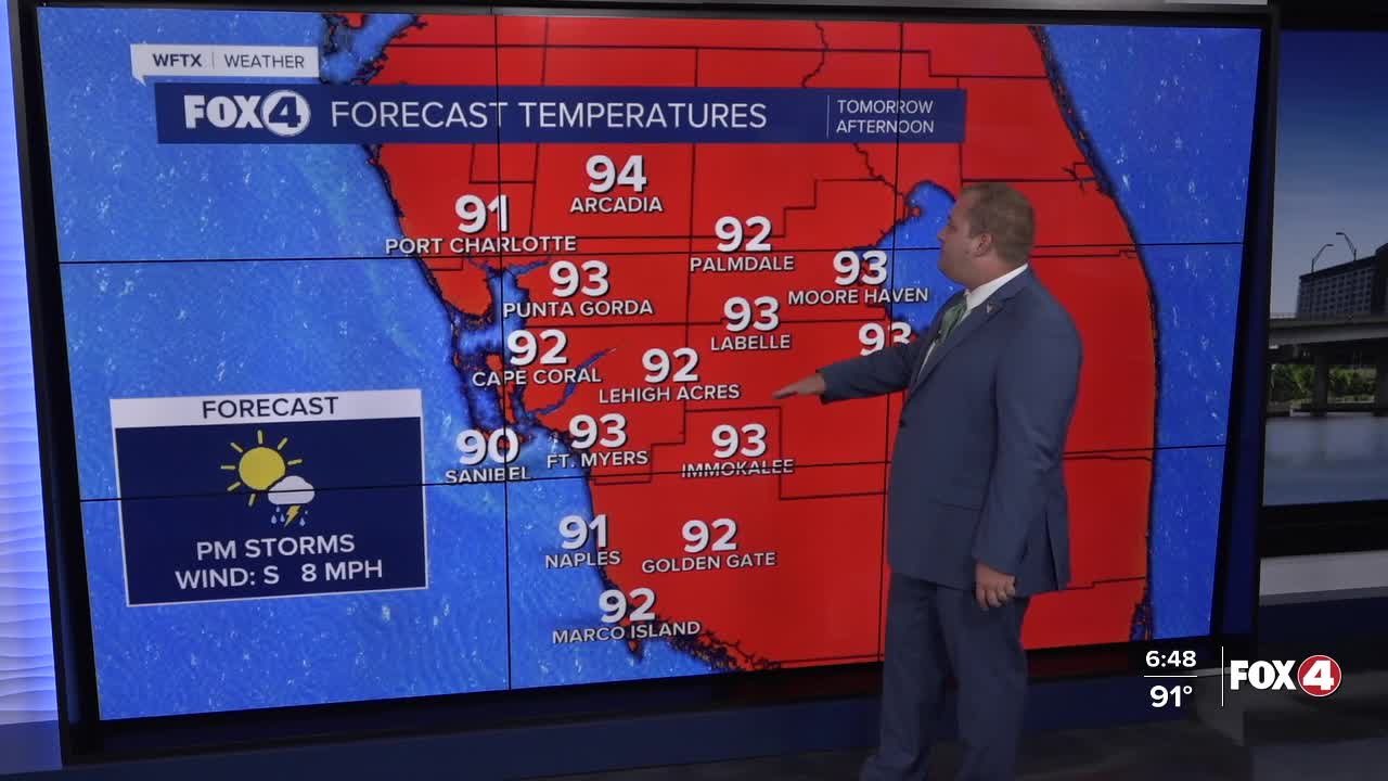
Early tomorrow morning, we could see see a few coastal showers, but storms chances will be mainly focused after 3pm along I-75. Inland should be mainly dry on Thursday. Our highs will be back in the low to mid 90s.
The rain chances will continue around 30-40% into the weekend with highs in the mid 90s. Rain chances will start to return to 60-70% on Sunday into next week as high pressure weakens.
TROPICS:
Tropical Storm Erin is gaining strength as it moves westward across the Atlantic, and is expected to become a hurricane by Friday. The storm could bring dangerous conditions to the northern Leeward Islands this weekend.
The National Hurricane Center reports in the 5pm update, that the storm is moving west at 17 mph with maximum sustained winds of 50 mph.
Erin will continue to move to west into the weekend, moving near or just north of the northern Leeward Islands over the weekend as it continues to strengthen.
Tropical-storm-force winds currently extend outward up to 60 miles from the center, with a minimum central pressure of 1001 mb.
Residents in the northern Leeward Islands, Virgin Islands and Puerto Rico should prepare for swells generated by Erin beginning this weekend. These swells could create life-threatening surf and rip current conditions.
While uncertainty remains about potential impacts to the Bahamas, the U.S. East Coast and Bermuda next week, the risk of dangerous surf and rip currents across the western Atlantic basin is increasing.
With hurricane season approaching its peak, now is the time to ensure preparedness plans are in place.
Meanwhile, another tropical wave over the Yucatan Peninsula is producing disorganized showers and thunderstorms. The system has a low 10% chance of development as it moves into the southwestern Gulf of Mexico on Thursday.
FOX 4 METEOROLOGIST ANDREW SHIPLEY
If you don't already have our Fox 4 mobile app, you can download it here.
