

Here is your forecast for Tuesday, July 22nd, 2025.
Most storm energy is on Florida's east coast tonight, leaving SWFL with scattered showers and a low risk for lightning. These showers are winding down and will become more isolated after 10pm.
Isolated showers are expected overnight into the morning hours, especially closer to the coast.
Keep the rain gear close! Showers and storms will become more numerous as we step through the day. Heavy rainfall will remain our primary concern, leading to some isolated flooding, especially in areas that are saturated from prior days' rainfall.
Morning temperatures will stay muggy in the upper 70s. Before wet weather arrives, highs are still expected near the average of 92°.
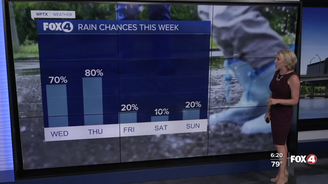
Thursday will be similar, featuring rounds of rain, before drier air begins to arrive on Friday. Friday's rain chances will decrease to 30%.
Looking ahead to the weekend, conditions will be much drier with only a 10-20% chance of an isolated shower or storm. It will be hot as well with highs in the mid-90s.
FOX 4 EVENING METEOROLOGIST KATIE WALLS
If you don't already have our Fox 4 mobile app, you can download it here.
