

Here is your forecast for Wednesday, October 22nd, 2025.
High temperatures crept into the upper 80s this afternoon, 2° above normal. Those warmer-than-average highs will persist, despite a cold front passing through SWFL tomorrow. That said, we will be enjoying lower humidity and windy conditions to finish the work week and head into the weekend.
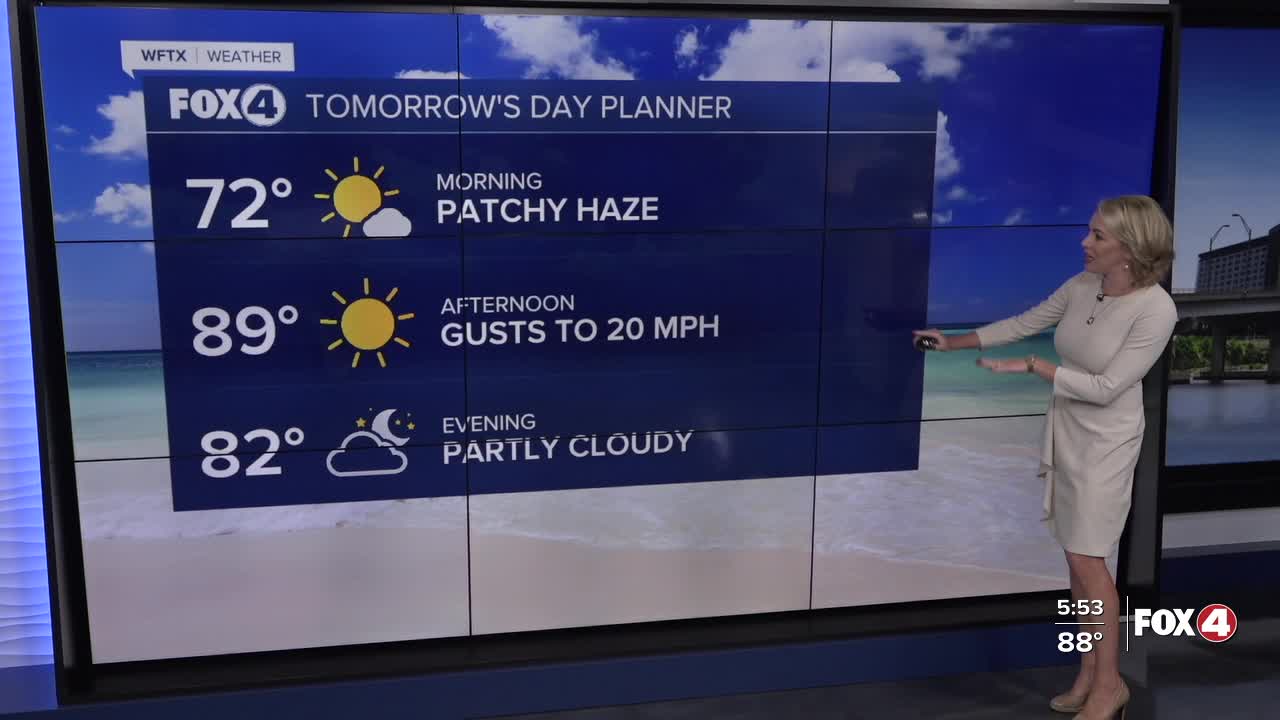
Tomorrow, ahead of that front, patchy haze and fog will be possible once again. Once the front comes through midday, you'll begin to feel the drier dew points and lower humidity filter in tomorrow afternoon. Winds will also be increasing in the afternoon, gusting to 20 mph.

Those winds will be gusty on Friday, Saturday and Sunday, 20-30 mph, leading to hazardous boating conditions.
For the latest on Tropical Storm Melissa, CLICK HERE
Looking ahead at the weekend, SWFL will be sunny, windy and dry on Saturday. We'll have a 20% rain chance on Sunday ahead of a storm system arriving on Monday forecast to bring SWFL our next chance for scattered showers and storms with rain chances increasing to 40%.
FOX 4 EVENING METEOROLOGIST KATIE WALLS
If you don't already have our Fox 4 mobile app, you can download it here.
