

Here is your forecast for Monday, August 4th, 2025.
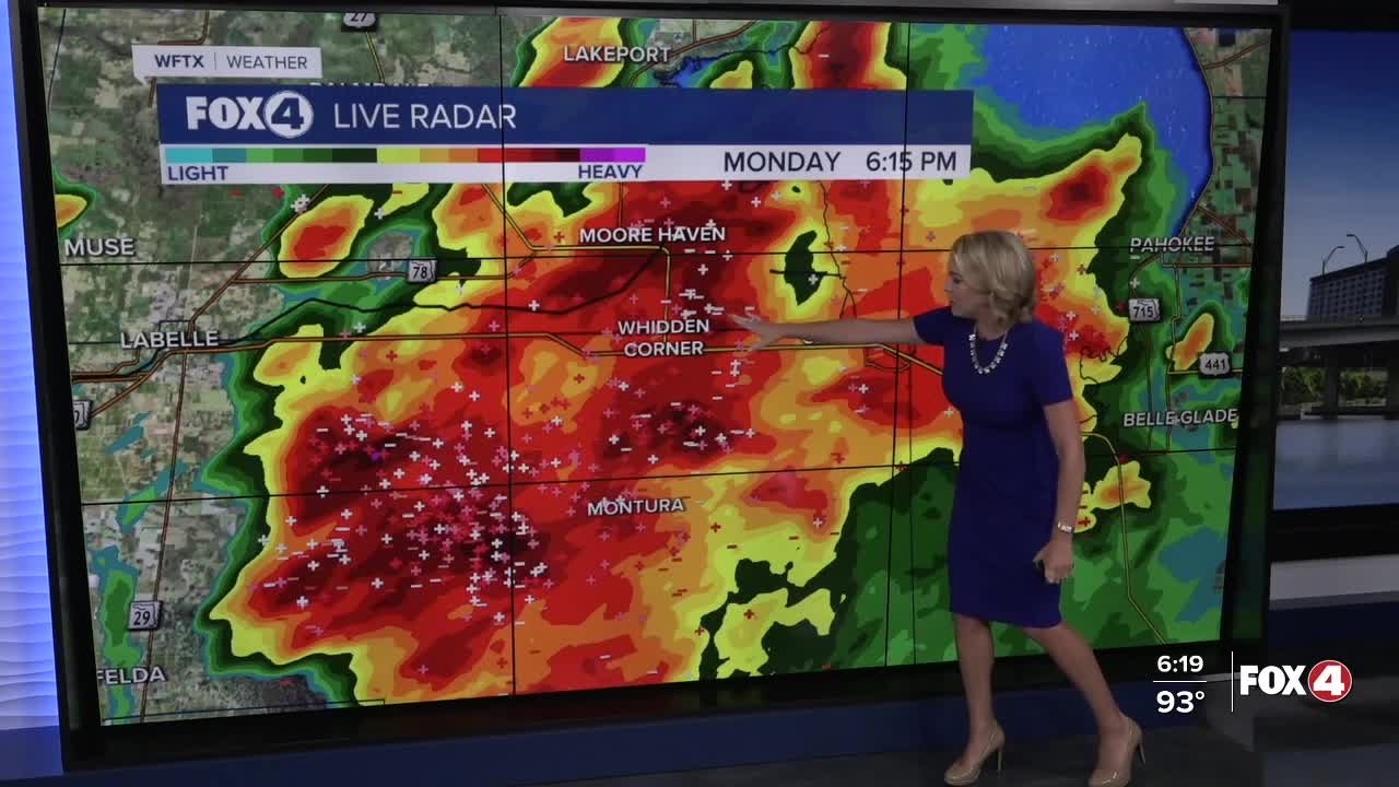
After a hot and humid afternoon, showers and storms are cooling down communities, especially inland. Strong storms are focused in Hendry and Glades counties where heavy rain, frequent lightning and gusts to 50 mph are possible. These storms will weaken after sunset and clear out of SWFL by 11pm.
We'll start off Tuesday in the upper 70s with lots of sunshine initially. It will be another hot day with highs in the mid-90s and feels like temperatures ranging from 102-108°.
After 2pm, stay weather aware as scattered storms develop. Southerly winds between 5-10 mph will maintain storm chances along the coast and inland. If more of a seabreeze develops, then most activity will be inland, along and east of I-75.
Later in the week our rain chances increase to around 70%. This increase in rain will start to keep our temperatures a little closer to our average of 92°.
FOR THE LATEST ON THE TROPICS, CLICK HERE.
FOX 4 EVENING METEOROLOGIST KATIE WALLS
If you don't already have our Fox 4 mobile app, you can download it here.
