

Here is your forecast for Thursday, July 17th, 2025.
Good evening, Southwest Florida!
Showers and thunderstorms are coming to end and should be wrapped up by 9pm. Overnight, skies will become partly cloudy as temperatures cool in the mid to upper 70s.
The area of low pressure we have been watching the last few days, is now bring heavy rain to parts of Louisiana, Alabama, and Mississippi. The National Hurricane Center is still monitoring this area and giving it a low chance, at 10%, of developing in the days ahead. As it moves away from Florida, high pressure will build this weekend. This will dry out the atmosphere.
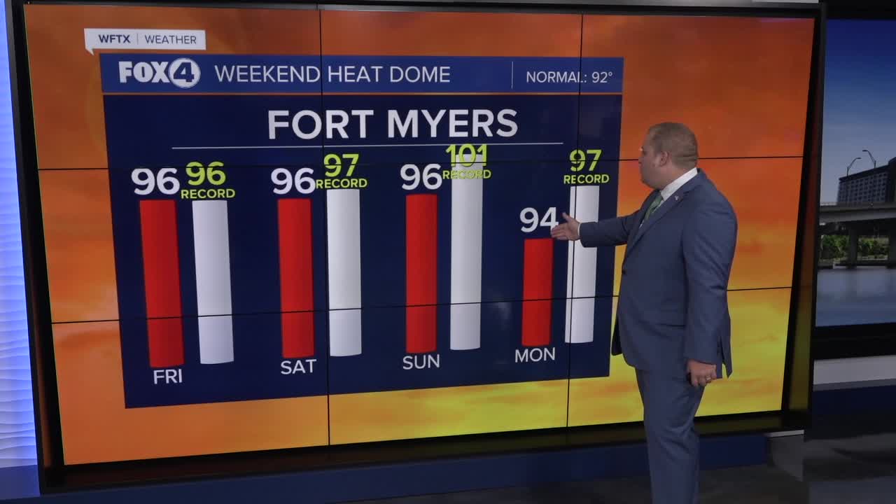
As such, we have bumped the chance of rain way down of Friday, Saturday and Sunday as the drier air moves into place. This will allow us more sunshine to wrap up the week and for our temperatures to climb. Our highs will be around 95°-96° Friday through Sunday.
The chance of rain starts to increase again on Monday and Tuesday with a 60-70% chance of afternoon showers and storms.
FOX 4 METEOROLOGIST ANDREW SHIPLEY
If you don't already have our Fox 4 mobile app, you can download it here.
