

Here is the forecast for Wednesday, February 25th, 2026.
Good morning, Southwest Florida! We are waking up cold once again with temperatures in the mid to upper 30s across a large portion of the area. The good news is the winds are light so wind chill is not an issue this morning. We do have Frost Advisories in effect for inland Sarasota, inland Charlotte, inland Collier and all of DeSoto, Glades and Hendry counties through 8AM. We warm up today all thanks to a shift in the wind. The winds will out of the south and that will push us in the low to mid 70s this afternoon.
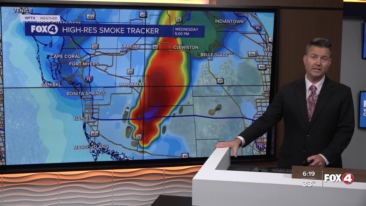
That shift in the wind will cause some issues with the smoke from the fire burning near I-75 in Collier county. So for anyone traveling through central and eastern Collier county today, please travel with caution, as the National Fire continues to burn.
Smoke will impact southern Collier county in the morning, including Everglades City, before winds shift and become southerly. Those southerly winds will transport smoke across I-75 tomorrow afternoon, through eastern Collier County and into Hendry County. So communities like Ave Marie and possibly Immokalee could see or smell smoke by noon and then Moore Haven and Clewiston later this afternoon. It is possible that areas even farther north like Lakeport and Buckhead Ridge could be impacted by the smoke late afternoon and evening.
The next front and chance of rain arrives Saturday. We will see a 60% chance of scattered showers and maybe a thunderstorm. So as you plan your weekend, expect Saturday to be a little wet. Sunday will be the better of the two days with partly cloudy skies and a high in the low 80s.
FOX 4 MORNING METEOROLOGIST TRENT ARIC
If you don't already have our Fox 4 mobile app, you can download it here.
