

Here is your forecast for Friday, January 17th, 2025.
An active weather pattern is settling in over SWFL. That includes periods of fog and showers and storms this weekend, plus higher rain chances heading through most of next week .
For tonight, we have a warm front stretched along the Florida Keys, lifting northward. This is producing thicker cloud cover and spotty rain showers. The higher humidity from this front will increase the risk for fog overnight, especially between 2am-8am, primarily along and west of I-75 closer to the coast.
Morning lows will be very mild in the low and mid-60s. As southerly winds increase on Saturday, temperatures will stay very warm in the upper 70s, and near 80° inland. This is the warm surge ahead of Sunday’s cold front. Overall, Saturday will be the drier of the two weekend days for outdoor plans.
Saturday night into Sunday, widespread fog is expected to impact travel and outdoor plans, so please keep an eye on that. Otherwise, for your Sunday, temperatures will stay warm ahead of an approaching cold front, as southerly winds increase to 25 mph.
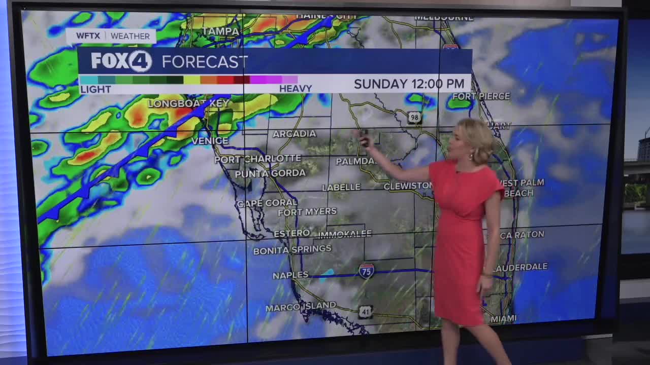
Showers and storms will enter Venice around Noon then gradually work their way through SWFL through the afternoon, exiting Collier county around 7pm.
Behind this front, much cooler air arrives for MLK, Jr. Day and Inauguration Day on Monday with lows in the upper 40s and lower 50s and highs struggling to hit 60° in some communities.
Keep the rain gear close. We’ll see another chance for rain on Tuesday into Wednesday, as our active pattern persists.
FOX 4 EVENING METEOROLOGIST KATIE WALLS
If you don't already have our Fox 4 mobile app, you can download it here.
