
Here is your forecast for Saturday, July 5th, 2025.
With deep tropical moisture being pulled into Tropical Storm Chantal, we will see increased storms this afternoons along the afternoon sea breeze. Highs will be around 90°.
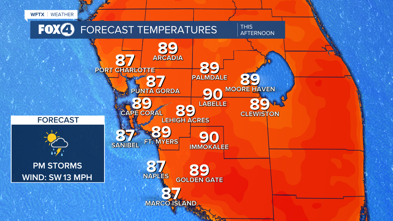
Storms will be firing up after 3pm and could linger until about midnight. Overnight, the skies will clear with lows dropping into the upper 70s.

Sunday will start with mostly sunny skies as temperatures climb into the lower 90s. Afternoon storm will start up around 2pm.
Slightly drier air will move in on Monday, dropping rain chances to around 40%. Higher rain chances will return midweek.
TROPICS:
Tropical Storm Chantal formed Saturday morning off the coast of South Carolina. Chantal is forecast to reach winds of 50 mph before landfall on Sunday. After landfall, Chantal will turn northeast into the Mid-Atlantic. Biggest threat for the Carolinas will be heavy rain causing flash flooding through Monday.

FOX 4 METEOROLOGIST ANDREW SHIPLEY
If you don't already have our Fox 4 mobile app, you can download it here.
