

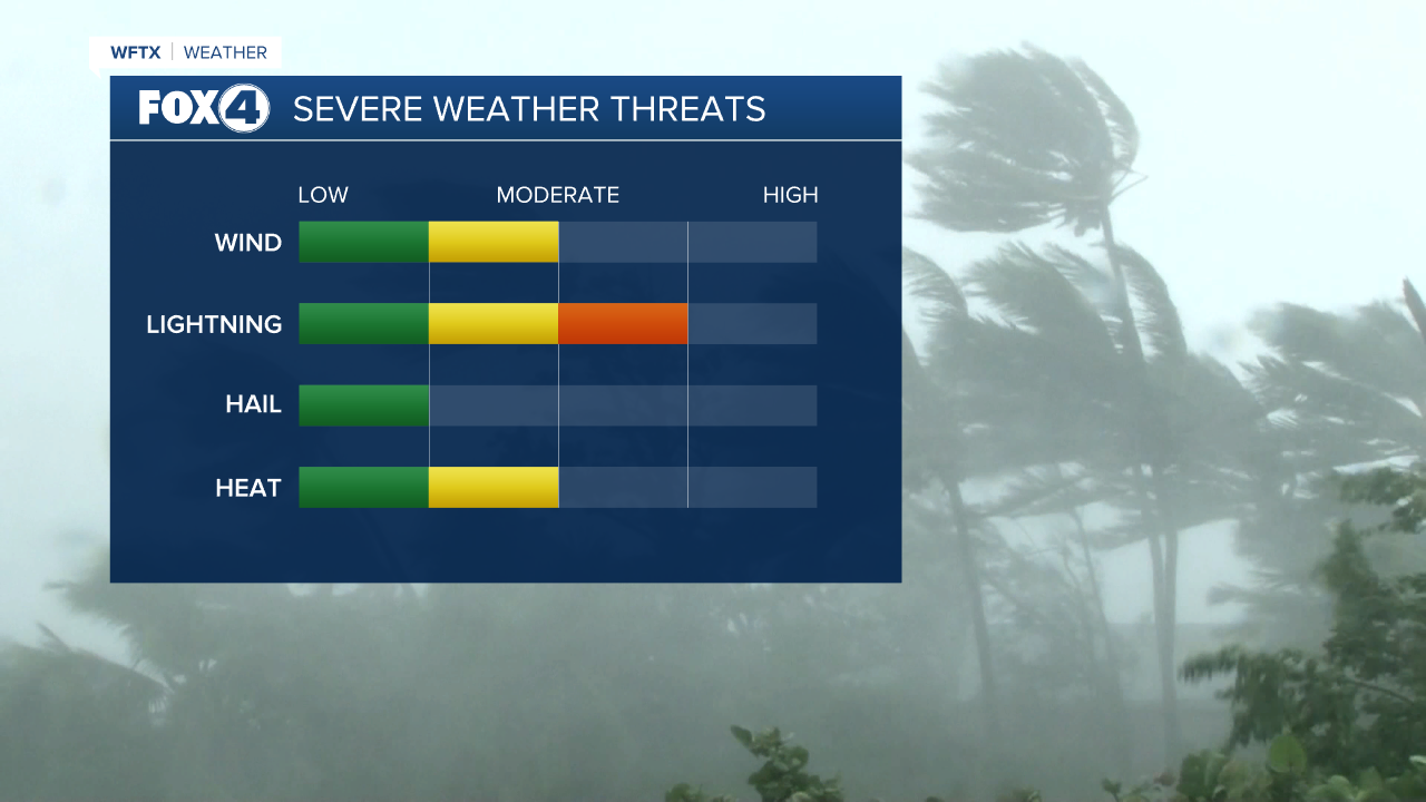
WFTX, Fla- — Despite the tropics getting busier, our forecast this afternoon will be pretty typical for this time of the year. Scattered showers and storms have a low chance of producing heavy wind and pea size hail at times. The biggest severe weather threat will be lightning through the afternoon hours.
Our Lightning Tracker allows up to pinpoint where some of the more intense and frequent lightning could strike. Models have slightly shifted since earlier this morning, but it still shows some of the more intense lightning impacting Southwest Florida around 3:30 p.m. This includes areas such as Cape Coral and Fort Myers. Models show areas east of I-75 in Collier County, such as Golden Gate and Immokalee, could see a similar amount of lightning. Most of the lightning activity looks like it will stay well to the north for Saturday.
A "moderate" level of lightning on the severe weather scale means people could see frequent cloud-to-ground lightning with 50 to 99 flashes every 15 minutes for any storm covering 20 square miles. It's important to remember that these models are always changing and lighting can be unpredictable at times. A saying to always remember while outside-- "if the thunder roars, get indoors."
