

Here is your forecast for Tuesday, January 27th, 2026.
Good morning, Southwest Florida! We are waking up with a Cold Weather Advisory until 9am this morning. Temperatures are in the mid to upper 30s in Charlotte, DeSoto and Glades counties and low to mid 40s in Lee, Collier and Hendry. The wind chill values have dropped into the low 30s this morning as the winds continue to gust out of the north-northeast near 20mph. That wind will continue this afternoon and despite mostly sunny skies our highs will only climb into the low 60s.
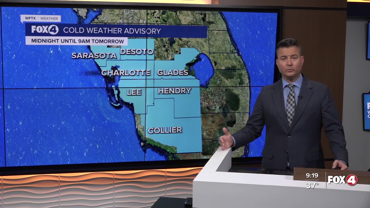
We get even colder tomorrow morning with temperatures falling into the low 30s north and upper 30s all the way south through Lee County and northern Collier county. Wind chill values will once again be in the upper 20s to low 30s. A second Cold Weather Advisory is in place from midnight through 9AM Wednesday. A Freeze Watch is in effect from Late Wednesday night through Thursday morning for DeSoto county.
We stay chilly this week with highs through Friday staying in the 60s. Friday will be the warmest day with a high of 69°. Another front arrives Saturday and that could bring some showers in the early part of the day with cloudy skies. Behind this front highs Sunday will only reach the mid 50s. We are forecasting 54° for a high, keep in mind our average low this time of the year is 55°. The coldest morning in the 7-Day forecast is Monday, where temperatures could be in the low 30s as far south as Lee County.
FOX 4 MORNING METEOROLOGIST TRENT ARIC
If you don't already have our Fox 4 mobile app, you can download it here.
