

Here is your forecast for Tuesday, December 30th, 2025.
A strong cold front moved this morning, keeping temperatures cooler than average this afternoon. With gusty winds following the front, a Small Craft Advisory remains in effect until 7pm.
Tonight, temperatures will drop into the 30s across SWFL, the coldest since January 25.
ACold Weather Advisory is in effect for all of SWFL, aside from coastal Collier County, until 9am on Wednesday.

Factor in the wind between 10-15 mph, and it will feel as low as 27°, especially in our inland and northernmost communities.
Cold Weather Advisories are in effect as we gear up for the COLDEST NEW YEAR'S EVE MORNING SINCE 2000! (Don't pick up any fallen iguanas...once it warms above 50°, they become active again.) Happy New Year! #flwx pic.twitter.com/bt4rPkXzvz
— Katie Walls, CCM, CBM (@KatieWallsTV) December 30, 2025
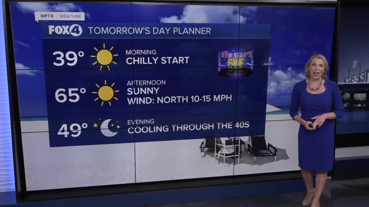
By 10am, temperatures will be climbing through the 40s. With lots of sunshine, highs are expected in the mid-60s, about 10° below average.
Ringing in the new year outdoors?
Layer up. Temperatures will be dropping through the 40s. While you may want extra layers, you won't need any rain gear, as dry conditions persist.
For Thursday, New Year's Day, morning lows will start in the 40s. Afternoon highs will climb toward 70° with ample sunshine.
By the weekend, temperatures will return to the mid to upper 70s.
FOX 4 EVENING METEOROLOGIST KATIE WALLS
If you don't already have our Fox 4 mobile app, you can download it here.
