

Here is your forecast for Friday, February 20th, 2026.
It was a warm, but beautiful day across Southwest Florida with highs reaching to mid to upper 80s. Not record setting but within 3 degrees of records in Fort Myers and Punta Gorda.
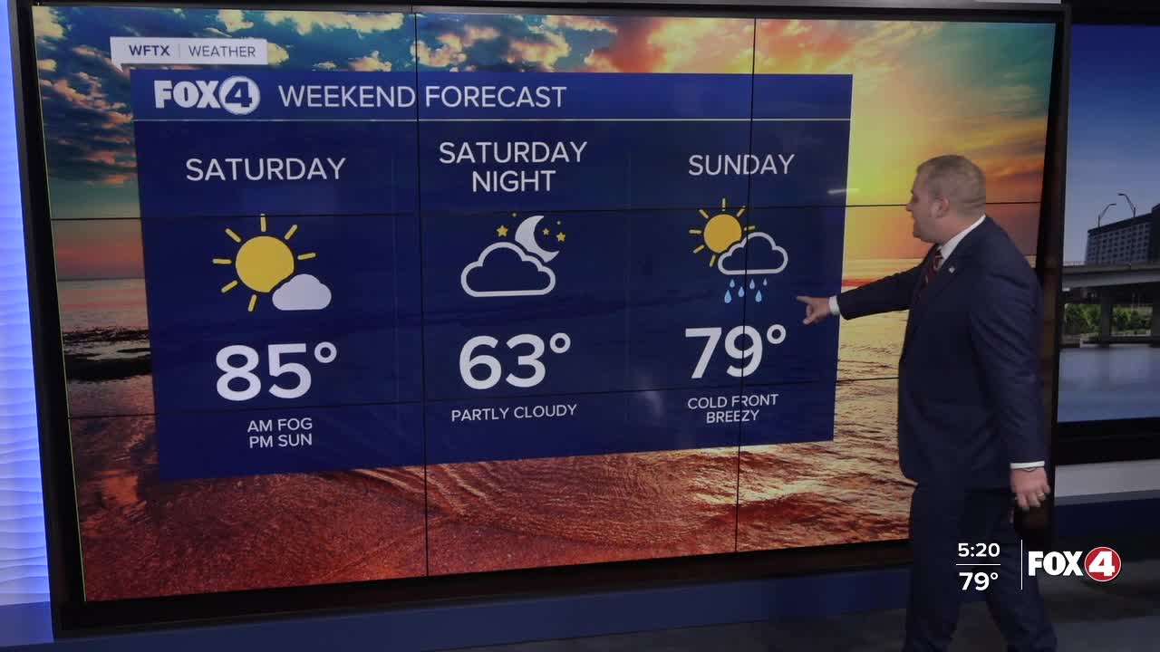
Tonight, we will see temperatures fall into the 60s with areas of fog developing after midnight. Fog is expected to be locally dense into mid Saturday morning.
The rest of Saturday will be sunny and warm with highs in the mid to upper 80s.
The next front arrives Sunday. That front will bring a line of showers, but will be overall light with most seeing less than 0.25" of rainfall. The front will will knock our temperatures back down with highs staying in the mid 60s both Monday and Tuesday. Tuesday morning will be our coldest start with wake up temperatures in the upper 30s along the coast and mid 30s inland.
Those temperatures will rebound quickly back into the 80s by the second half of next week.
FOX 4 METEOROLOGIST ANDREW SHIPLEY
If you don't already have our Fox 4 mobile app, you can download it here.
