

Here is your forecast for Tuesday, September 9th, 2025.
Unsettled weather continues across SWFL. For this evening, isolated flooding will remain our primary concern, especially in southwestern Collier county where rounds of rain continue to move onshore from the Gulf.
This round of rain will subside by 10pm.
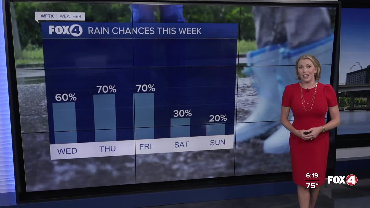
A stationary front will remain parked across Central Florida through Friday. This will keep clouds and scattered rain in the mix through the end of the work week with isolated flooding and lightning our primary threats each afternoon. High temperatures will remain in the upper 80s.
A shortwave of energy diving into the Southeast will help to force that front southward, allowing drier air to arrive this weekend. Both Saturday and Sunday are looking much drier with dew points in the lower 70s and only a 20-30% rain chance.
FOX 4 EVENING METEOROLOGIST KATIE WALLS
If you don't already have our Fox 4 mobile app, you can download it here.
If you don't already have our Fox 4 mobile app, you can download it here.
