

Here is the forecast for Friday, October 24th, 2025.
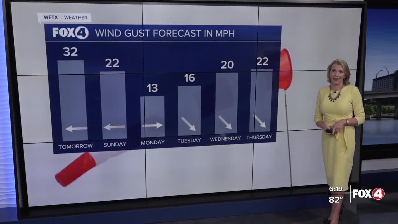
The wind will be the big weather story this weekend with gusts to 35 mph on Saturday and up to 25 mph on Sunday. This has triggered a Small Craft Advisory in effect until 8pm on Sunday.
Overnight temperatures will drop in the upper 60s and lower 70s. Mostly sunny skies are forecast for your Saturday with a few more clouds in the afternoon. Highs are expected in the upper 80s over the weekend.
Easterly winds will drive in Atlantic moisture, bringing a 20% rain chance on Sunday, increasing to 40% on Monday as an area of low pressure swings through.
The BIG changes with the forecast arrive midweek with the strongest front of the season so far! This will bring a BIG COOL DOWN right in time for Halloween with highs in the 70s and lows in the 50s for some communities.
We are closely monitoring Tropical Storm Melissa in the northern Caribbean, expected to become a Major Hurricane this weekend. Flash-flooding will be a huge concern with this slow-moving system through next week in Haiti, the Dominican Republic and Jamaica.
FOX 4 EVENING METEOROLOGIST KATIE WALLS
If you don't already have our Fox 4 mobile app, you can download it here.
