

Here is your forecast for Saturday, January 31st, 2026.
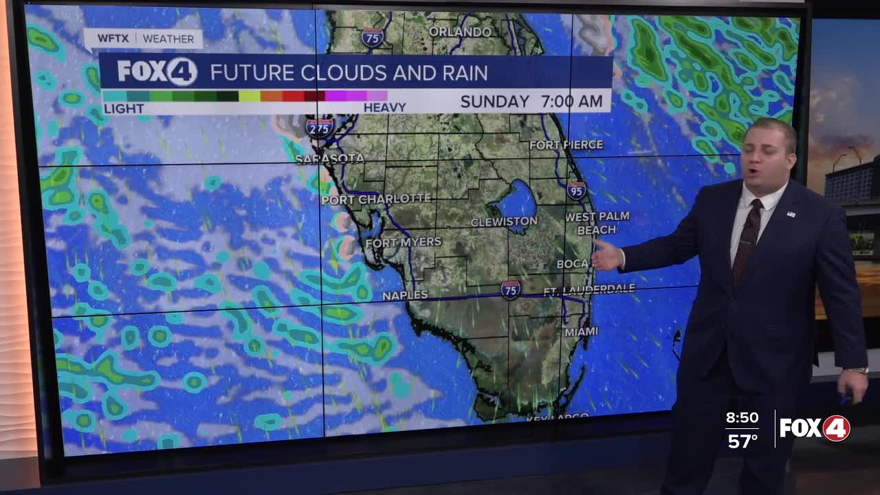
We are waking up this morning to scattered rain showers ahead of our cold front. That front will clear SWFL around 1pm.
Behind that front, strong gusty winds will drive in cold Canadian air. This will lead to the coldest night we've felt in 16 years with records possible both Sunday and Monday mornings.
Starting this afternoon, strong gusty winds are expected as high as 40 mph inland and close to 50 mph near the coast. A Wind Advisory goes into effect at 3pm on Saturday.

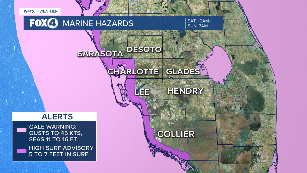
Winds out of the northwest will cause falling temperatures through the afternoon. They will also lead to DANGEROUS boating conditions. A Gale Warning is in effect starting Saturday morning through Sunday morning. Waves are expected between 10 to 15 feet in the Gulf. A High Surf Advisory is also in effect starting Saturday afternoon through Sunday night. Waves are expected between 5 to 7 feet in the surf zone of the beaches.
The big story will be the frigid temperatures Sunday and Monday mornings. Temperatures will be in the 20s and low 30s. Factor in the wind, it will feel more like the teens and 20s across SWFL.

Because of the frigid temperatures, Extreme Cold and Freeze Warnings are in effect with Cold Weather Advisories at the coast Saturday night through Sunday morning.

As the cold air flows over the relatively warmer Gulf waters, a flurry or two will be possible at the coast between 1am and 7am Saturday night/Sunday morning. No accumulation is expected.

Monday morning will be equally cold, warranting widespread alerts once again. This marks the coldest air mass since 2010.

70s return midweek.
FOX 4 METEOROLOGIST ANDREW SHIPLEY
If you don't already have our Fox 4 mobile app, you can download it here.
