

Here is your forecast for Sunday, November 8th, 2025.
We kicked off your Sunday in the upper 60s and low 70s. High temperatures will stay in the mid to uppers 80s. Otherwise, expects lots of sunshine this afternoon with a 20% chance for a passing shower, mainly inland.
Get ready for the coldest air since January!
The next cold front arrives Monday morning, and you will feel it pass through your neighborhood. Winds will shift and become northerly, gusting 25 to 30 mph, driving in much cooler and drier air. High temperatures on Monday are only expected in the low 70s, but that high will occur in the morning. By 3pm, temperatures will be in the low to mid 60s.

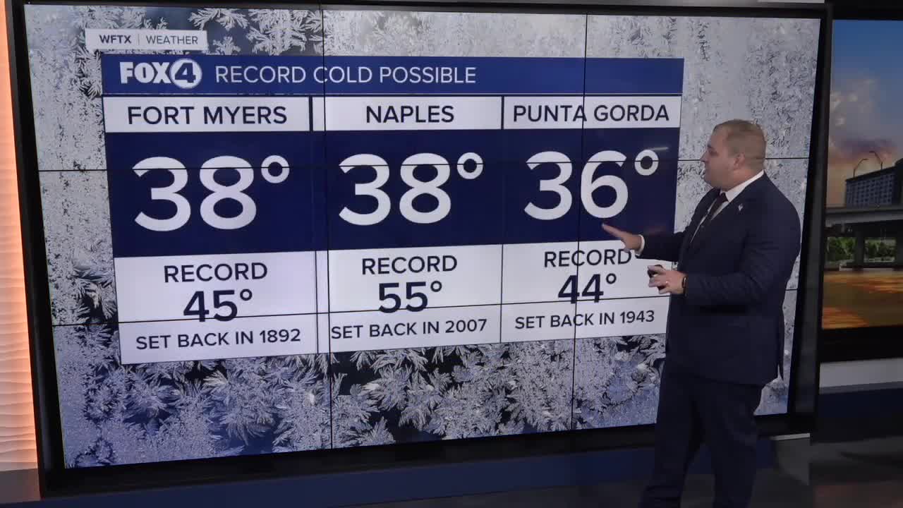
Tuesday morning will start off with the coldest lows since January with widespread 30s across SWFL. The current forecast has temperatures dropping as low as 38° in Fort Myers. To put into perspective how unusual that is. It record low for Nov 11th, is 45° in 1892, with the normal low for the date of 63°. Then you had in the feels like temperatures, and it will feel like 20s and 30s.

YES, that means we are on 'Falling Igauna' Watch. Igaunas need external heat to regulate their body temperatures, given they are cold blooded. When temperatures fall below 45°, they become stunned. DO NOT touch them! When temperatures later Tuesday morning, they will wake up.

Veterans Day (Tuesday) is only expecting a high of 61°. This would make this Veterans Day the coldest on record, breaking the record of high of 62 in 1977!
Wednesday will start off with the mid 40s as well, but the warm-up begins Wednesday afternoon as highs return to the 70s and climb from there.
FOX 4 METEOROLOGIST ANDREW SHIPLEY
If you don't already have our Fox 4 mobile app, you can download it here.
