

Here is your forecast for Friday, January 30th, 2026.
We are waking up a bit warmer this morning compared to Thursday morning. In fact, 10 to 15 degrees warmer.
Mostly sunny to partly cloudy skies are forecast for your Friday afternoon with highs in the upper 60s and lower 70s. While below seasonable norms, it will overall be a beautiful day!
Mild temperatures will continue tonight, with lows in the 40s and 50s.
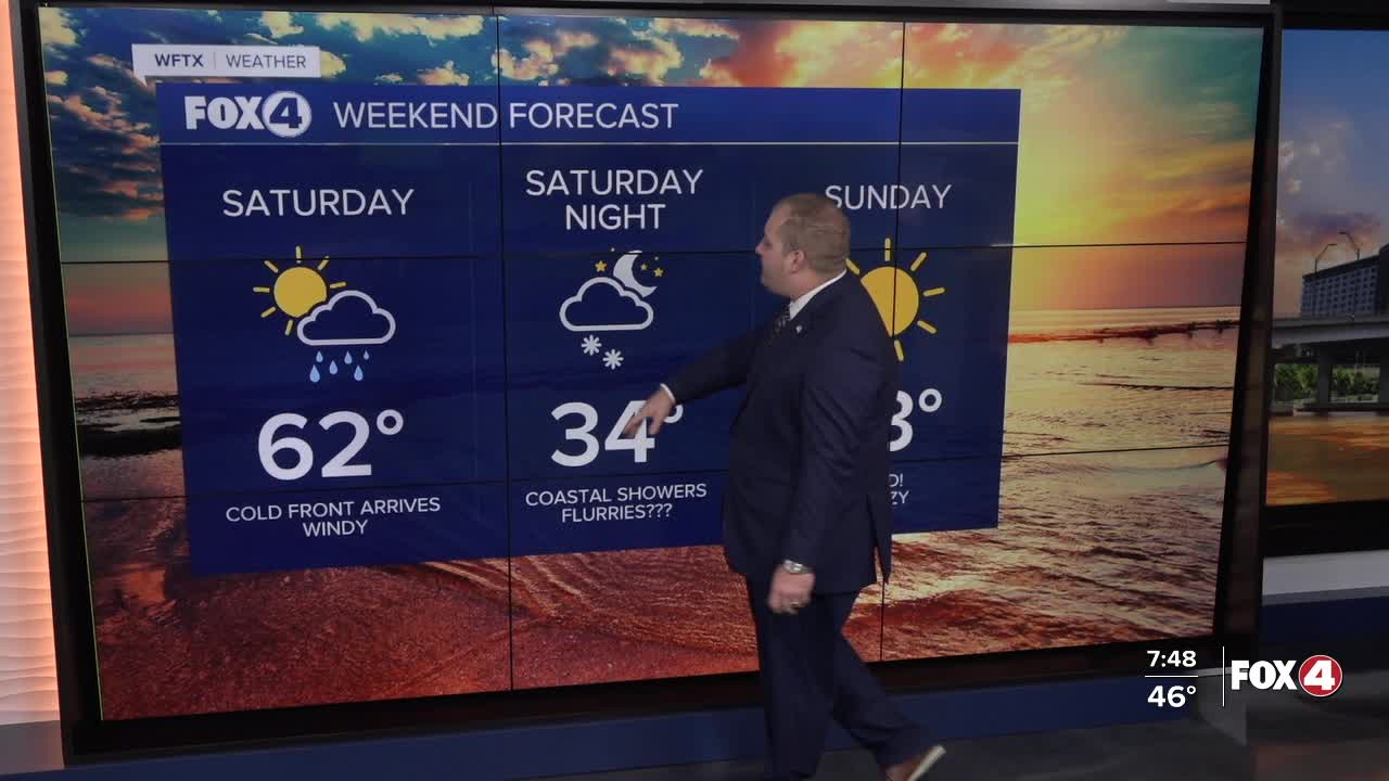
Our next front moves through Saturday morning, bringing with it scattered rain showers. Behind that front, strong gusty winds expected as high as 35 mph inland and close to 40 mph near the coast. Those winds out of the northwest will cause falling temperatures through the afternoon. They will also lead to DANGEROUS boating conditions. A Gale Watch is in effect starting Saturday morning through Sunday morning. Waves are expected to between 10 to 15 feet in the Gulf.

As the cold air flows over the relatively warmer Gulf waters, a flurry or two will be possible at the coast between 1am and 7am Saturday night/Sunday morning. No accumulation is expected.

Sunday morning will be chilly with widespread 30s across SWFL, including wind chills in the teens.

Extreme Cold Watches have been issued for Hendry, Glades and DeSoto counties. Freeze Watches are in effect for inland Collier, inland Lee and eastern Charlotte counties for Saturday night into Sunday mornings.

Monday morning will be equally cold, warranting widespread alerts once again. This marks the coldest air mass since 2010.
70s return midweek.
FOX 4 METEOROLOGIST ANDREW SHIPLEY
If you don't already have our Fox 4 mobile app, you can download it here.
