

Here is your forecast for Saturday, January 24th, 2026.
While we track a powerful winter storm impacting millions this weekend, SWFL has a beautiful weekend ahead.
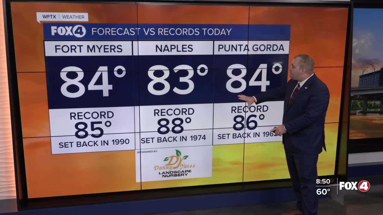
This morning, we woke up with areas of dense fog with lows in the low to mid-60s. That fog has since cleared, with mostly sunny skies and highs in the mid 80s. In fact, might even be flirting with some records in Fort Myers and Punta Gorda.
Meanwhile this afternoon, our sea breeze will spark some inland showers and thunderstorm. This will be a welcome sight given our current drought situation, but any lightning could spark brush fires.
Sunday will also start with patchy fog, but overall, I am expecting higher winds on Sunday, especially in the afternoon, with southerly gusts to 25 mph. Aside from the breeze, expect partly cloudy skies and warm temperatures in the 80s once again.
While we expect a beautiful weekend, that will be the total opposite for much of the nation.

A significant, long-duration winter storm will bring widespread heavy snow, sleet, and freezing rain from the Southern Rockies to New England through Monday.
Widespread travel disruptions, prolonged power outages, and vast tree damage is likely.

Some locations, like Washington, DC, are expected to receive 12" of snow followed by ice on Sunday.

Frigid temperatures, gusty winds, and dangerous wind chills will expand from the north-central US to the Southern Plains, MS Valley, and Midwest.
The cold front associated with that winter storm will arrive to SWFL on Monday, bring some scattered morning showers and another dose of winter to the area. Chilly weather looks to stick around throughout the weekend likely into the first week of February.

FOX 4 METEOROLOGIST ANDREW SHIPLEY
If you don't already have our Fox 4 mobile app, you can download it here.
