

Here is your forecast for Sunday, July 20th, 2025.
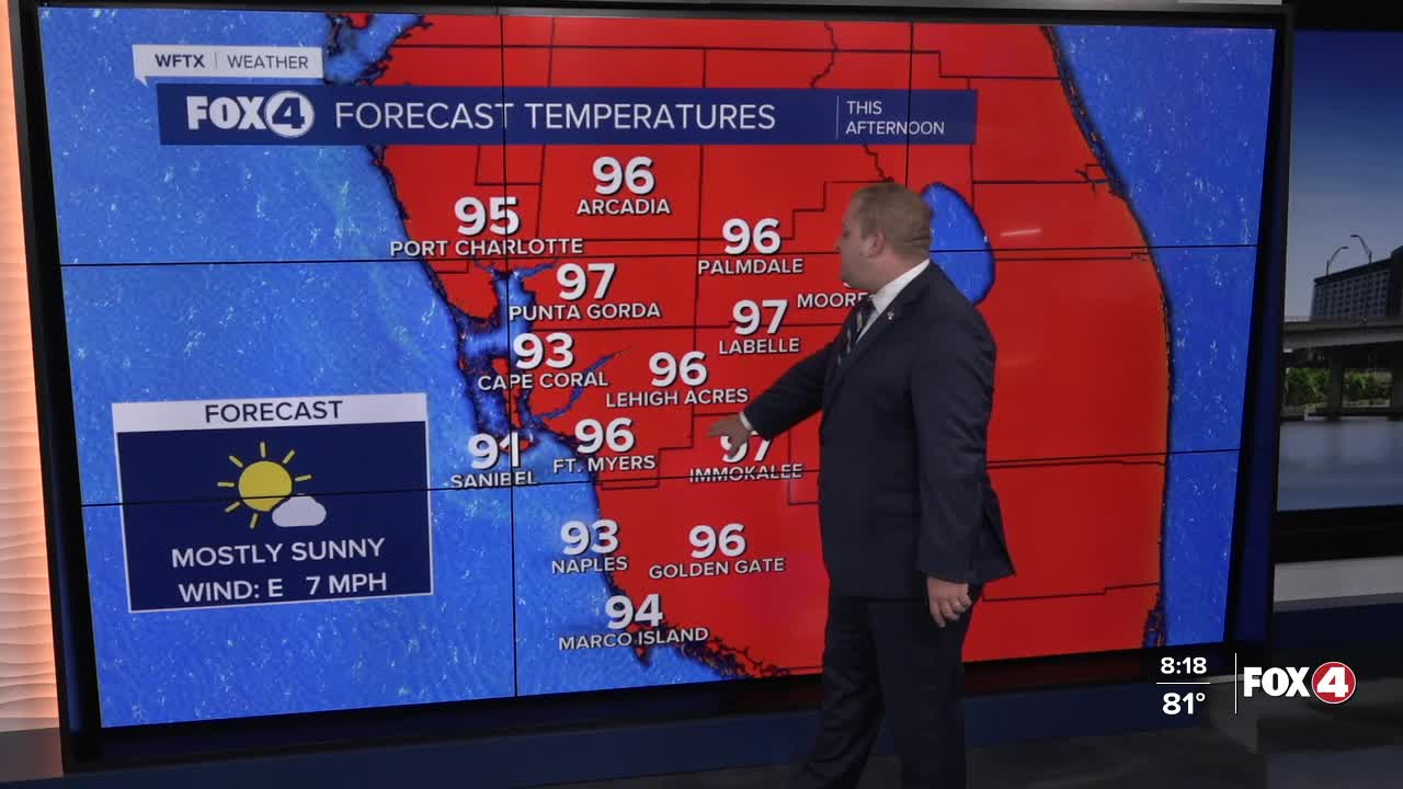
This morning we are waking up with temperature in the low 80s and mostly sunny skies. By this afternoon, temperatures will warm into the mid to upper 90s with feels like temperatures between 105° and 110°. This is due to much drier air sitting over the state this weekend.

Due to the dier air, our rain chances will only be around 20-30% Sunday afternoon. The majority of us won't be cooler down by rain to help cool us off.
Looking ahead to next week, our chance of rain climbs back up on Monday with a 60% chance of afternoon showers and storms. That rain chance increase up to 80% by Wednesday as we return to our wet weather pattern with highs in the upper 80s to near 90°.
TROPICS UPDATE
A tropical wave located about 1,000 miles east-southeast of the Lesser Antilles is currently producing disorganized showers and thunderstorms, according to the National Hurricane Center.
Environmental conditions appear only marginally conducive for development during the next day or so while the system moves west-northwestward at about 10 mph.

By the middle of the week, environmental conditions are forecast to become unfavorable for further development.
The National Hurricane Center gives this system a low 10% chance of formation through the next 48 hours and a low 10% chance through the next 7 days.
FOX 4 METEOROLOGIST ANDREW SHIPLEY
If you don't already have our Fox 4 mobile app, you can download it here.
