

Here is your forecast for Wednesday, January 14th, 2025.
We are tracking the coldest air of the season, and, in some communities like Fort Myers, nearly four years!
Ahead of tomorrow's strong cold front, scattered rain will move in, mainly after midnight. These showers will continue through the morning commute. The risk for strong and severe storms will stay very low but an embedded thunderstorm isn't out of the question. Mainly, we're expecting a round of much-needed rain. Rainfall amounts are generally forecast between 0.25" to 0.50".
By Noon, the front will have cleared SWFL. Winds will pick up out of the northwest, gusting between 25-30 mph. Small Craft Advisories are in effect for Thursday.
Thursday afternoon, clouds clear out, making way for cold temperatures Thursday night and Friday morning.
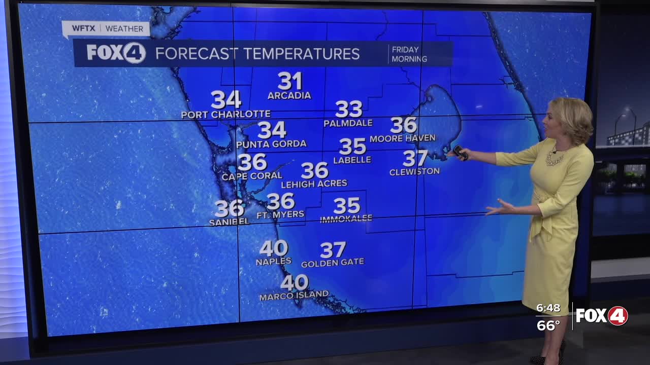
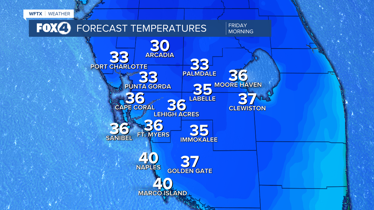
We'll wake up to widespread 30s across SWFL. The forecast for Fort Myers is 36°, the coldest morning since January 30, 2022. (The record is 32° set back in 1927.)
Factor in the wind, and it will feel more like the 20s and low 30s.

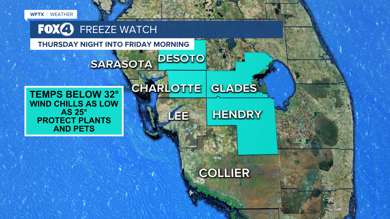
There is a Freeze Watch in place for DeSoto, inland Charlotte, Hendry and Glades counties Thursday night into Friday morning as sub-freezing temperatures are possible. Remember to protect your plants and bring pets indoors.
Friday afternoon will stay chilly in the lower 60s. By Saturday afternoon, high temperatures climb into the lower 70s, before another front swings through on Sunday.
This means a cold start to next week once again, and a chilly Martin Luther King, Jr. Day with highs in the 60s.
FOX 4 EVENING METEOROLOGIST KATIE WALLS
If you don't already have our Fox 4 mobile app, you can download it here.
