

Here is your forecast for Tuesday, February 3rd, 2026.
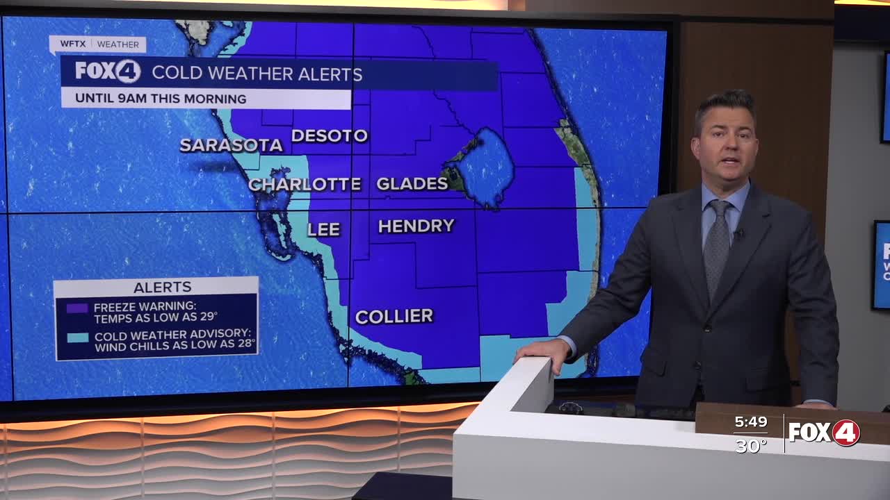
Good morning, Southwest Florida! We are waking up to yet another cold morning with some areas below freezing once again. A Freeze Warning is in effect until 9AM from all of DeSoto, Glades and Hendry counties along with inland Lee, inland Collier and inland Charlotte counties. The coastal areas of Lee, Collier and Charlotte counties have a Cold Weather Advisory in place until 9AM with the possibility of wind chill values in the upper 20s.
This afternoon we will see lots of sunshine, and thanks to a east-northeasterly breeze we will warm up even more today with highs in the upper 60s to near 70°. Our average this time of the year is 76°.
Tonight, we will be clear and chilly once again with some locations north seeing temperatures drop back in the upper 30s while most of us will be in the mid to upper 40s. We are forecasting 47° in Fort Myers and while that is warmer it is still below our average low of 55°.
We warm up in the low to mid 70s tomorrow ahead of yet another cold front that will bring some much needed rain early on Thursday and bringing in another cool blast of air that will keep our highs Thursday and Friday in the low to mid 60s. The overnights will not be as cold as the last few days, we will stay in the low to mid 40s.
Looking ahead to the weekend, the mornings will be chilly staying in the upper 40s, but the afternoon will be fantastic with mostly sunny skies and highs in the low to mid 70s.
FOX 4 MORNING METEOROLOGIST TRENT ARIC
If you don't already have our Fox 4 mobile app, you can download it here.
