

Here is your forecast for Sunday, January 25th, 2026.
While we track a powerful winter storm impacting millions this weekend, SWFL has had beautiful weekend thus far.
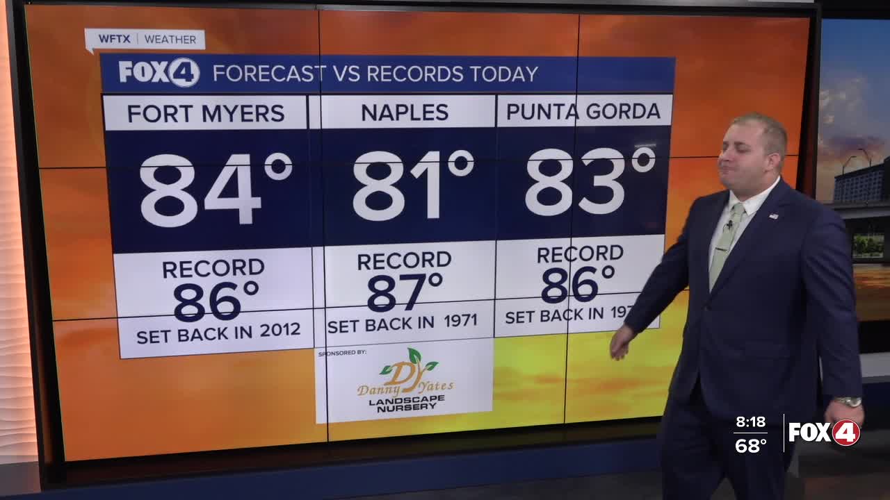
This morning, we woke up with areas of dense fog with lows in the mid to upper 60s. That fog has since cleared, with mostly sunny skies and highs in the low to mid 80s expected this afternoon. While we did break the record high temperatures in Fort Myers on Saturday, Sunday should stay a degree or two below records as winds will be increasing. Expect those gusts up to 25 mph out of the south.
While we expect a beautiful weekend, that will be the total opposite for much of the nation.

A significant, long-duration winter storm will bring widespread heavy snow, sleet, and freezing rain from the Southern Rockies to New England through Monday.
Some locations, like Washington, DC, are expected to receive 12" of snow followed by ice on Sunday.
Frigid temperatures, gusty winds, and dangerous wind chills will expand from the north-central US to the Southern Plains, MS Valley, and Midwest.
The cold front associated with that winter storm will arrive to SWFL on Monday, bring some scattered morning showers and another dose of winter to the area.
Tuesday morning, we will likely see another round of Cold Weather Advisories as temperatures will be in the 30s and 40s with wind chills in the low to mid 30s.

Chilly weather looks to stick around throughout the weekend likely into the first week of February.

FOX 4 METEOROLOGIST ANDREW SHIPLEY
If you don't already have our Fox 4 mobile app, you can download it here.
