

Here is your forecast for Thursday, January 29th, 2026.
Cold Weather Advisories and Freeze Warnings are in effect until 9AM as morning temperatures fell once again into the 30s and low 40s. Factor in the wind and it feels more like the upper 20s and low 30s across SWFL, for the third morning in a row.
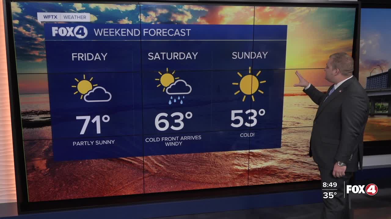
With easterly winds picking up in the afternoon, Thursday should be a bit warmer with highs in the upper 60s and around 70° in Naples and Fort Myers. Lots of sunshine is expected. Friday will be mild as well with morning lows in the 40s (versus 30s) and highs in the lower 70s.
This is the warm surge ahead of Saturday's cold front. Saturday will start with scattered showers as a front moves through in the morning. In its wake very windy weather is expected with gusts to 35 mph both Saturday and Sunday.
That cold wind over a mild Gulf could trigger some coastal showers in the wake of the front. And as temperatures drop into Sunday morning, a few flurries can't be ruled out. Right now the chances are low, but 10-20% chance.
Sunday morning we will wake up to low 30s across the area, within records for some communities, and only reach a high of 53°.
It gets even colder on Monday with the possibility of records lows in the low 30s.
FOX 4 METEOROLOGIST ANDREW SHIPLEY
If you don't already have our Fox 4 mobile app, you can download it here.
