

Here is your forecast for Tuesday, January 20th, 2026.
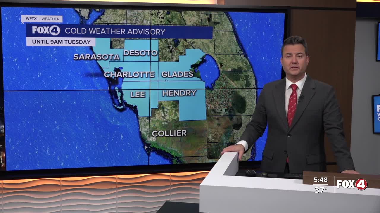
Good morning, Southwest Florida! We are waking up with a Cold Weather Advisory until 9AM for every county in Southwest Florida except Collier. Wind chill values in upper 20s to low 30s this morning thanks the brisk northeast wind that will gust 20-25mph throughout the day. We will see mostly sunny skies and our afternoon highs will reach the low 70s.
Overnight, clear and chilly with temperatures falling into the mid 40s north of the Peace River and low 50s to the south.
Wednesday the temperatures will continue to climb and will be just shy of 80° with mostly sunny skies. An approaching cold front will fizzle out across north FL midweek sending some clouds in our direction on Thursday, but no rain is in the forecast.
Friday through Sunday the warm weather returns with highs in the low 80s running above our average of 75°. We do see another cold front that arrives early next week which will knock our temperatures back down.
FOX 4 MORNING METEOROLOGIST TRENT ARIC
If you don't already have our Fox 4 mobile app, you can download it here.
