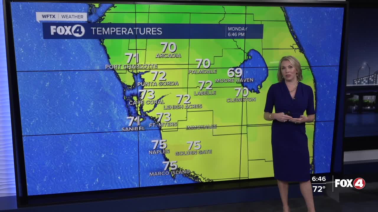


Here is your forecast for Monday, January 12th, 2025.
Last evening's cold front allowed temperatures to drop to where they should be for this time of year in the 50s this morning. But, the drier dew points in the 40s lasted all of this morning, and tonight they're back to 60°. This will set us up for a milder start in the upper 50s and lower 60s across SWFL.
Mostly cloudy skies will hang on tonight into tomorrow. High temperatures will climb into the upper 70s.
Moderate to severe drought continues across SWFL, and we need the rain. Our next chance for rain arrives Wednesday night into Thursday, as a cold front approaches and moves through.
We'll see a 20% rain chance on Wednesday with a 60% chance Wednesday night into Thursday, especially in the morning. Following this front, highs on Thursday will struggle to reach 70° with some locations staying in the upper 60s.
The coldest morning will be Friday morning. We are forecasting 40° and many locations inland and north will start in the mid to upper 30s. Lots of sunshine is forecast on Friday but with the cool air moving into the area, our highs will stay in the low 60s, 10-15° below average.
FOX 4 EVENING METEOROLOGIST KATIE WALLS
If you don't already have our Fox 4 mobile app, you can download it here.
