


ST. PETERSBURG, Fla. — Two new University of South Florida studies reveal hidden ocean drivers of rapid hurricane intensification.
Rapid Intensification: An increase in the maximum sustained winds of a tropical cyclone of at least 30 kt (35mph) in a 24-h period.
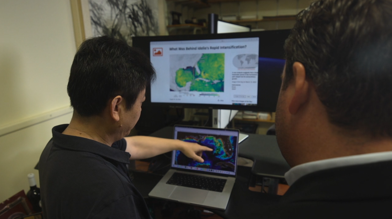
WATCH: Why Hurricanes Ian and Idalia exploded overnight — It wasn't just warm water
Since 2017, Florida residents have suffered devastation from a multitude of rapidly intensifying hurricanes. Hurricanes Ian, Michael, Ian, Idalia, Helene and Milton.
RIVER PLUME INTENSIFIED HURRICANE IDALIA (Published Feb. 4, 2025)
River Plume: "is a freshened water mass that is formed in the sea as a result of mixing of river discharge and saline seawater."
Think of it like oil floating on water - the lighter freshwater sits on top of the heavier saltwater.
As Hurricane Idalia approached Florida's Big Bend in August 2023, the warm waters of the Gulf fueled its growth. In less than 24 hours, the storm intensified from a Category 1 to a Category 4, a phenomenon known as rapid intensification.
Dr. Chuanmin Hu is a professor of Oceanography at the USF College of Marine Science. He tells Tampa Bay 28 reporter Michael Paluska he had a glider in the Big Bend area of Florida studying algal blooms and red tide. Then, Hurricane Idalia was forecast to come, and the mission changed.
"When you collected the data and you processed it, did you even think that you would see something like this? What did you think you would find?" Paluska asked.
"Well, if we don't have this hurricane, I would say, well, the river plume is quite typical in the Eastern Gulf at this time of year, in July, August, almost every year we have a river plume. But what is especially notable in that year is that the river plume is very large, very long. I mean, it lasted very long, for several months. It's very thick. So that is unusual."
Dr. Hu explained how the river plume supercharged Hurricane Idalia. Essentially, the freshwater puts a lid on top of the saltwater.
"Basically, what happened in 2023, with hurricane Idalia, was that we had a two-layer system. The first layer on the ocean surface is a river plume, a lighter, less dense, and less salty layer. The bottom layer of the ocean is colder and denser, with a high concentration of salt. The surface layer is warmer than the bottom layer. So the presence of this surface layer would prevent water mixing, and that means when the wind kicks in, the hurricane still absorbs energy from the surface layer, because the cold, cold water is not brought up to the surface to cool down the ocean."
Prior studies have highlighted the impact of river plumes on the intensity of tropical storms in other parts of the globe. A 2007 paper found that more than two-thirds of Category 5 storms between 1960 and 2000 traversed the vast plumes of the Amazon and Orinoco Rivers in South America.
For Hu and his co-authors, a key takeaway from their recent study is the importance of integrating river plumes into hurricane forecasting.
"Accurate forecasting is critical for people to plan as a storm approaches," Hu said. "Our study demonstrates the value of considering the influence of river plumes on storm intensification. If there's a persistent river plume in the right location at the right time, you might have the perfect conditions for a powerful storm."
"PRESSURE POINT" FUELS HURRICANE IAN (Published Dec. 25, 2024)
Satellite data can tell you how warm the Gulf is at the surface, but it takes a buoy to reach the subsurface and bottom. And that same buoy can carry a lot of high-tech gadgets to help collect data about what's going on with more than just warm water, but also currents. One of the most dynamic in the Gulf, the Loop Current, played a pivotal role in the rapid intensification of Hurricane Ian.
"The loop current didn't interact with the western shelf at a critical location, so the shelf water stayed still, was not flushed, so it stayed warm that year," Dr. Yonggang Lium, associate professor and lead author of the recent study, told Paluska. Surface temperatures were warmer, about one to two degrees above climatology, but subsurface temperatures were higher than climatology by two to three degrees. That indicates very warm water in the subsurface layer, which you cannot detect from satellites; that's detected by these buoys."
Climatology: "the study of climate and how it changes over time"
"For hurricane Ian, it was able to tap into water, and you're able to prove that that water was two to three degrees warmer than the past 27 years?
"Yes!" Liu responded.
"Shocking?" Paluska asked.
"Yes! Very, very shocking!" Liu said. "We wonder why it was induced very rapidly from category three to five within 12 hours, within 12 hours, that's rapid identification. What caused that? The subsurface warm temperature gives the answer."
The bottom line is that these studies, along with new data, can save lives and help forecast the potential for future storms to intensify rapidly.
"The more real-time observations we have of the entire water column, the better predictions we can provide, and the safer our communities will be," Dr. Liu said. "This type of monitoring provides more complete data to predict the intensity of future storms."
"With a better prediction and with more accuracy, for sure, more lives will be saved, and more properties will be saved," Dr. Hu said. "It adds to the existing knowledge, existing information. And also, I'm myself. I'm not a modeler. I don't forecast hurricanes. So the study outcome is useful for the modelers to consider whether there will be a persistent, extensive river plume; if that's the case, you may have faster intensification."
Share Your Story with Michael

A lot goes into the price of paradise and Michael Paluska focuses on every aspect. From the job market and housing to how Florida’s growth impacts our state’s wildlife. Send Michael tips to keep these important conversations going.
.

"I know how important it is."
A Tampa woman created a list to help families find food during a possible SNAP funding lapse. Tampa Bay 28's Chad Mills spoke with Kas Miller about the inspiration behind her project.
